FAA rules you need to know BEFORE flying a drone

Drones have been one of the most popular Christmas gifts for kids and adults for several years now, mainly because the technology has evolved so much over the past couple of years, that you can now find drones with various capabilities in price ranges from $40+. And let’s face it, it is fun to have a flying camera to play around with!

So, you got a drone as a gift for Christmas or your birthday? Now what? Of course, your first instinct is to take it out of a box to try it around your house or at a local park as soon as possible, but you should learn a couple of things before taking it out for a spin if you don’t want to get into ‘hot water’ with FAA, law enforcement, or even your neighbors!

What you need to know before flying your new drone

  1. Understand FAA regulations: Fly Responsibly 

Drones are legally defined as aircraft, so their operations are subject to regulation by the Federal Aviation Administration (FAA).   You should be aware of the basic rules of safe drone operations: The FAA restricts flying your drone to altitudes of 400’ (above the ground) or less, cannot fly over people or traffic, and cannot interfere with traffic patterns of takeoff and landing areas, if near an airport. All of this basic safety information is now covered in study materials for a TRUST (The Recreational UAS Safety Test) Test, which is now a required test for all recreational (hobbyist) drone flyers. This regulation came out in June 2021, and you have to carry a certificate that you passed the test if you are flying the drone recreationally. You can learn more about this test on our Trust Test blog post or watch a YouTube Vlog about it.

2. Drone Registration: You Have To Have It

If you have a drone that weighs more than 0.55lbs, you will need to register it here

3. Airspace Authorization: Apply As Needed

If you live near a major airport or a restricted military area, you are most likely in controlled airspace, and you should check that before flying your drone even in your backyard.

Generally, you need to know what type of National Airspace (NAS) you intend to fly in before launching the drone. you can read my detailed post on this here, and if you are in controlled airspace, you will need to apply for FAA authorization (you can watch my detailed YouTube Vlog on how to do it).

5. Operate Your Drone Within the Visual Line of Sight

Keep your drone within visual line of sight at all times. Meaning, you have to be able to see your drone at all times. Otherwise, you are in the “Beyond Visual Line of Site” mode of operation and you need to have a special permit from the FAA to do so. So, if you don’t see it, you are not compliant with this regulation.

6. Flying your drone at night

Do not fly at night unless your drone has special lighting that allows you to know its location and orientation at all times.

7. Drone License: Do you need it?

You will need to obtain FAA Part 107 Certification if you want to legally sell drone services or any media (photos, videos) generated by your drone. V1DroneMedia offers a variety of Drone Training classes, including the Part 107 Drone License Prep Course in the Cleveland, Ohio area. You can also learn more about getting an FAA Part 107 Certification here. If you intend to operate your drone as a hobbyist only, you will not need a Part 107 license, but you will still need to get the Trust Certificate, which is free and only takes a short time to get.

8.  What NOT to do when flying a drone.

  • Never interfere with emergency response activities such as disaster relief, any type of accident response law enforcement activities, firefighting, or hurricane recovery efforts

  • Never fly over any persons or moving vehicles

  • Do not operate your drone carelessly or recklessly

Now that you know a bit about the rules, are you ready to fly? If you feel like you need some guidance in getting started to fly your drone or want to learn more advanced skills, check out our Hands-On Drone Flight Training sessions that we hold in the Cleveland, Ohio, area, and Contact Us to get started. Have fun and fly safely!

A Guide to Becoming an FPV Drone Pilot

If you're looking for an exciting and unique hobby that combines technology, creativity, and adrenaline, then becoming an FPV drone pilot might just be the perfect fit for you. FPV, or first-person view, drone piloting involves using a remote-controlled drone equipped with a camera and goggles that allow you to see the drone's perspective in real-time. It's like being a bird in flight, soaring through the skies and experiencing the world from a whole new perspective.

FPV drones came into popular culture in a big way a few years ago with a viral video of an FPV drone flying through a bowling alley, and since then FPV drones have soared in popularity. V1DroneMedia also produces videos using FPV drones to bring a new aerial perspective distinctly different from a traditional drone shot. Check out a few of our videos below.

DJI FPV Drone Video with GoPro

Ohio Wheat Harvest Drone Video using DJI Inspire 2, DJI FPV, and DJI Mavic 2

But before you can take to the skies as an FPV drone pilot, there are a few things you need to know. In this guide, we'll walk you through the process of getting started, mastering the basics, building your skills, and joining the community of FPV pilots.

Getting Started: Familiarize yourself with the FAA rules and get your TRUST Certificate

While this may seem mundane, you don’t want to get in hot water with the FAA just as you start to fly your drone, so learning the rules for operating unmanned aerial vehicles in the national airspace is important. If you are just starting out with drones flying them for fun (as a hobby), you should study for and pass the FAA TRUST Test (The Recreational UAS Safety Test) to get your free TRUST certificate, required to have on hand for any person operating drones as a hobbyist. You can read and watch our blog/vlog post-FAA TRUST Test for Drone Pilots Explained to learn more.

Onto the fun part: Choosing Your First Drone

If you are motivated and handy (you don’t have to be an electrical engineer), you can build your own drone. Check out an FPV drone building guide from a local Cleveland FPV drone pilot, Elliot Spaudie.

There are also a wide variety of FPV drones available to buy, ranging from simple toy models to high-end racing drones. For beginners, I recommend starting with a basic model that is easy to fly and affordable. A couple of options for beginners, depending on your budget, would be the Emax Tinyhawk II Freestyle RTF Kit, the BetaFPV Cetus Pro, DJI Avata, or DJI FPV.

Learning to Fly: Mastering the Basics

Once your drone is set up and ready to go, it's time to start practicing your flying skills. There are a few fundamental skills you'll need to master before you can start doing more advanced maneuvers. These include:

  • Throttle control: Learning how to control the speed and altitude of your drone.

  • Pitch and roll: These controls allow you to move your drone forward, backward, left, and right.

  • Yaw: This control allows you to rotate your drone left or right.

To practice these skills, find an open and safe location to fly your drone. Often you can do this at a local park, but check the airspace you are in, and then municipal and park regulations to make sure they don’t restrict drone flying there.

Building Your Skills: Advanced Techniques and Maneuvers

Once you've mastered the basics of flying your drone, it's time to start pushing yourself and trying out more advanced maneuvers. Here are a few to get you started:

  • Flips and rolls: These are basic aerobatic maneuvers that involve flipping your drone forward, backward, or sideways while maintaining altitude.

  • Power loops: This is a more advanced maneuver that involves flipping your drone upside-down while maintaining forward momentum, then completing a loop before righting the drone.

  • Racing: If you're interested in competing against other FPV pilots, racing is a great way to test your skills and see how you stack up against the competition.

It's important to remember that these maneuvers can be dangerous if not done correctly, so be sure to practice in a safe and legal manner. If you're not confident in your abilities, consider practicing in a simulator before attempting them in real life.

Joining the Community: Networking and Job Opportunities

One of the great things about becoming an FPV drone pilot is the sense of community that comes along with it. There are a variety of local and online communities of FPV pilots (check out Cleveland FPV Drone Racing Facebook Group), where you can share tips, tricks, and experiences with other enthusiasts. Joining these communities can also open networking and job opportunities.

If you are still a student, one great option for you to meet like-minded people of similar age may be to attend a Drone Racing camp, such as Spire Academy Drone Racing Camp in a Cleveland suburb of Geneva, Ohio.

One growing area where FPV pilots are in demand is in the field of specialized aerial videography. While drone videography has been around for a while, FPV drone cinematography has really caught on in the last couple of years thanks to its stunning aerobatic aerial footage that puts the viewer in the middle of the action (check out the use of FPV drone cinematography in the 2022 movie Ambulance). FPV drones are becoming an increasingly popular tool for filmmakers, ad producers, and content creators. If you have a knack for capturing breathtaking footage and solid FPV drone flying skills, this could be a great career path to explore.

Note that if you are planning to fly your FPV drone for commercial purposes (i.e. get paid to fly your FPV drone), you will need to get your FAA Part 107 Drone Certificate to be compliant with the FAA rules for commercial drone pilots. Learn more about it in our blog post Drone Pilot License, and check out V1DroneMedia’s Cleveland-based drone training classes which include Part 107 License Prep.

Another area where FPV pilots are in demand is in the field of drone racing. As the popularity of drone racing continues to grow, there are more and more opportunities for pilots to compete in local and national races. In addition to the thrill of competing, many drone racers also earn money through sponsorships and endorsements.

Finally, there are opportunities for FPV pilots in the field of drone education and training. As more and more people become interested in drone technology, there is a growing demand for experienced pilots who can teach others how to fly safely and responsibly. Whether through online tutorials, in-person classes, or private lessons, there are a variety of ways that FPV pilots can share their skills and knowledge with others.

Being an FPV drone pilot can be a thrilling and rewarding hobby and a career. Whether you're interested in racing, videography, or just flying for fun, there are a variety of opportunities to explore So what are you waiting for? Grab your drone, don your goggles, and take to the skies – the adventure awaits!

V1DroneMedia is a Cleveland-based drone services provider, including producing aerial cinematography and drone fly-through videos (we also fly FPV drones!) for a variety of industries, and providing drone training for groups and individuals. Contact us if you are need a consultation!

Drone Mapping Advantages vs. Conventional Mapping Methods

Drone mapping is becoming a popular use case for drones, or unmanned aerial vehicles. There are several reasons why it is getting so much traction with various industries:

1.    Cost-effectiveness: Drones can cover large areas quickly and at a lower cost than traditional survey methods, such as using manned aircraft or ground surveys.

2.    High-resolution imagery: Drones can capture high-resolution images and data that can be used for detailed mapping and analysis.

3.    Safety: Drones can access areas that are difficult or dangerous for humans to reach, such as steep terrain, hazardous sites, or structures.

4.    Speed: Drones can cover large areas quickly, reducing the time required to complete a mapping project.

5.    Flexibility: Drones can be easily deployed and controlled, allowing for mapping in a wide range of conditions and environments.

6.    Data collection: Drones can be equipped with a variety of sensors, such as cameras, LiDAR, and thermal imaging, to collect a wide range of data for various mapping applications.

7.    3D mapping: Drones can generate 3D models of landscapes and structures, providing more accurate and detailed information than traditional 2D maps.

8.    Regular updates: Drones can be used for regular monitoring and updating of maps at a fraction of the time and cost vs. traditional methods, which enables tracking changes over time possible for organizations that couldn’t afford it before.

9.    Accuracy: Drone mapping can provide just as accurate maps as traditional methods, as it can use GPS and other technologies (such as including ground control points) to ensure precise GIS information.

Most of the drone mapping can be performed using drone photogrammetry, but other technologies such as lidar can also be used with the drone technology for certain use cases.

If you want to learn more about drone mapping, its uses, how much it costs, and how it is performed, read more details in our What is Drone Mapping blog post, and view V1DroneMedia drone services for AEC industries.

V1DroneMedia is a drone services provider in the Cleveland, Ohio, area. We service midwestern states, and our drone services include drone mapping, drone videography (including FPV drones), drone photography, full video production, virtual tours, drone construction services, and drone training.

V1Dronemedia’s Chief Drone Pilot has 20+ years of experience in commercial airlines, and 30+ years in remote control aviation. If you are interested in contracting drone mapping services and are looking for a quote, contact us!

What is Drone Mapping

Drone mapping, also known as aerial mapping or unmanned aerial vehicle (UAV) mapping, is the process of using drones equipped with cameras and other sensors to capture and process aerial imagery and data to create detailed maps, 3D models, and other visualizations.

How is drone mapping performed?

The drone flies over the area of interest and takes multiple overlapping images. These images are then processed using specialized software to create a detailed map or 3D model of the area.

Typically the process of drone mapping involves several steps: planning the flight, capturing the data, processing the data, and analyzing the data. Some of the key technologies used in drone mapping include photogrammetry (see our drone photogrammetry post to learn more), lidar, and thermal imaging. The outputs are usually in the form of Orthomosaic maps, 3D models, point clouds, and other forms of data that can be used for various purposes.

What can drone mapping be used for?

The maps and models created by drone mapping can be used for a wide range of applications, such as land surveying, construction planning and management, crop monitoring, and environmental conservation.

What are the advantages of drone mapping vs. traditional mapping methods?

Drone mapping can provide a cost-effective and efficient way to collect detailed data and imagery of large areas, including hard-to-reach places, and can provide a high level of detail not possible with traditional mapping methods. Read our Drone Mapping Advantages vs. Conventional Mapping methods blog post for more details (especially if you need to make a business case to use drones for mapping). See more details in our blog post Drone Mapping advantages vs. Conventional Mapping Methods.

How much does it cost to contract drone mapping services?

The cost of drone mapping can vary depending on a variety of factors, such as the size of the area being mapped, the level of detail required, and the equipment and software used. Typically V1DroneMedia charges for time on site, processing time, and software use, which varies on a project basis. This cost can range from a few hundred dollars for a small project to several thousand dollars for a large or complex project.

Who can use drone mapping services?

1.     Agriculture: Drones can be used to create detailed maps of crops and fields, which can help farmers optimize crop yields and make better-informed decisions about planting, fertilizing, and harvesting.

2.     Construction: Drones can be used to create detailed maps of construction sites, which can help contractors plan and execute projects more efficiently.

3.     Real estate: Drones can be used to create detailed maps and 3D models of properties, which can help real estate agents market properties more effectively. Drones are also used to make informative listing videos and photos - you can read more about it in our Why Use Drone In Real Estate Photography and Video blog post

4.     Surveying: Drones can be used to create detailed maps of land and structures, which can help surveyors and engineers plan and design projects more accurately.

5.     Environmental monitoring: Drones can be used to create detailed maps of environmental features such as wetlands, forests, and wildlife habitats, which can help conservationists and scientists monitor and protect these areas.

6.     Emergency response: Drones can be used to create detailed maps of disaster-stricken areas, which can help emergency responders plan and execute rescue and recovery operations more effectively.

7.     Inspection: Drones can be used to create detailed maps of industrial plants, power lines, and other infrastructure, which can help organizations identify and address potential safety and maintenance issues.

These are just a few examples - drone mapping can be used for many other applications as well. V1DroneMedia provides drone mapping services and more AEC Drone Servies in Ohio and other Midwest states. Read about our founders who brought a combined 40 years of aviation and business experience to start V1DroneMedia.

Contact us if you are looking for a drone mapping project consultation or a quote. Don’t forget that in order to perform drone mapping one has to hold FAA Part 107 commercial drone certificate, and be aware of and comply with the FAA airspace regulations for the area where the drone mapping missions are flown.

What is DJI Fly Safe? Is unlocking a Geo Zone in DJI Fly Safe the same as getting an FAA Authorization?

What is DJI Fly Safe? Is unlocking a Geo Zone in DJI Fly Safe the same as getting an FAA Authorization?

I am a commercial drone pilot, drone services provider, and drone educator based in Cleveland, Ohio, and I get a lot of questions concerning drone operations from drone hobbyists, drone training students, and those that read and watch my drone education content. Recently I noticed that there is some confusion concerning DJI Fly Safe Geo Zone Unlocks to remove flying restrictions that prevent the aircraft to fly vs. getting an FAA Authorization to fly in controlled airspace.

Where To Fly Drones in Cleveland

Cleveland aerial views are some of the best available in the state of Ohio!  OK, we may be a little biased since we are based in the Cleveland area. We are lucky to have an extensive lakefront with Lake Erie spanning much of the Northeast Ohio border, downtown Cleveland, and its suburbs.

Drone photo of downtown Cleveland skyline and historic Cleveland Coast Guard Station

1.     Downtown Cleveland has many scenic locations: Cleveland sports stadiums, Rock and Roll Hall of Fame, Public Square, Playhouse Square, etc. You can't beat the Cleveland skyline aerial view with Lake Erie in the background!

But be aware, if you intend to fly your drone downtown Cleveland, that Burke Lakefront Airport is located there just next to the Voinovich Bicentennial Park. Burke Lakefront Airport is in controlled (class D) airspace, requiring you to obtain FAA authorization to fly your drone within 5 miles of its location (you can read our blog post Where Can I Fly My Drone for detailed information and tutorial on FAA authorizations).

Aerial photo of Rock and Roll Hall of Fame with Burke Lakefront Airport and Lake Erie in the background

In addition, during any major league baseball (MLB) or national football league (NFL) open-air stadium games there is a Temporary Flight Restriction (TFR) that is in effect, which applies to the MLB and NFL games at the stadiums located downtown Cleveland.  TFRs can also go into effect for other reasons, such as VIP movement, which prohibits all drone flights in the area.

2.     Lakefront locations in Cleveland that offer some scenic lakefront drone photography: Lakewood Park with the Solstice Steps and Cleveland downtown skyline, Lorain Lighthouse in Lorain, and Fairport Harbor Breakwater Lighthouse in Mentor. Make sure you check municipality ordinances when you are choosing where to launch and land your drone.

Aerial view of the Edgewater Park with downtown Cleveland Skyline

3.     University Circle neighborhood of Cleveland offers plenty of scenic architectural and natural sites with Wade Oval, Cleveland Museum of Art and its lagoon, Museum of Natural History, Case Western Reserve University campus, and Little Italy nearby. Some of this area is within 5 miles of the Burke Lakefront Airport, so you may need FAA authorization to fly your drone there.

Aerial photo of Cleveland Museum of Art in Fall

4.     Unfortunately, you cannot launch and land your drone in most Cleveland Metroparks, including their lakefront locations: Edgewater Park, Wendy Park, Whiskey Island, E 55th Street Marina, East 72nd fishing area, North Gordon Park Boat Ramp, Euclid Beach Park, and Huntington Reservation Beach in Bay Village. There are several designated areas where you CAN fly your drone in the Cleveland Metroparks, see the details in their Drone Policy.

If you have any questions about flying in Cleveland and surrounding areas, need a drone project quote, or are looking for drone training classes that we provide, Contact us!

Why hands-on drone flight training is important for drone pilots

As a new year begins, many of us are making New Year resolutions. V1DroneMedia's resolution is to bring the most up-to-date and simple-to-understand drone knowledge to you: information about drone regulations, drone industry, equipment capabilities, flight skills, and other drone information to those interested in learning more about drone technology and getting started in flying drones safely and legally.

A lot of drone pilot schools are focused on education and compliance with the FAA drone laws and regulations and getting the Part 107 Remote Pilot License. And this IS where you should start your drone journey if you are thinking about getting a drone or just purchased one because you want to be aware of where and how to operate your drone safely and legally, avoid any negative law enforcement or 'well-wisher' attention, and can intelligently answer any questions about how and where you can legally fly.  We have covered all these subjects in our blog post A Beginner's Guide To Drones and have regularly scheduled Drone Training Courses that you can attend to learn this information and get ready for the FAA Part 107 Drone Certification Test.

V1DroneMedia’s Chief Pilot teaching Traffic Patterns during an FAA Part 107 Drone License Prep Course

However, learning safe drone operations or procuring your Part 107 Drone Pilot Certificate is only a starting point (one should walk before they run). The essential part of your drone training should be getting hands-on time flying the drone. That means being comfortable with operating the drone apps (such as DJI, Litchi, etc.), performing takeoffs and landings, learning to maintain and calibrate the drone, performing routine flight maneuvers, operate the camera to take pictures and video. These skills cannot be taught in a classroom, and you need them to fly the drone proficiently if you are serious about becoming a drone pilot. You must get out there and learn to fly your drone, just like manned aviation pilots spend hours flying in a simulator or with an instructor before flying on their own (I spent hours and days in simulator sessions during my training as a commercial pilot, and had to do recurrent training every year in a simulator as well).

While flying a drone doesn't come with the liability of flying an aircraft worth millions of dollars with people on board, it is still very important to understand the systems that make a drone work and be proficient with your equipment to ensure safe operation.

A drone is usually needed to shoot an aerial photo or video of a certain subject matter or an object on the ground or even high up in the air, and you need to have skills to fly the drone to focus on a subject, position the camera of the drone to shoot video or photo from different angles while flying around the subject, maybe even track the subject and shoot continuous video or photographs.

V1DroneMedia’s Chief Pilot with students during a drone flight session

Many of these flight maneuvers are built into intelligent flight modes in the apps nowadays, but you would still need to know how the different intelligent flight modes work and become proficient at setting them up and incorporating them into your workflow (if needed). Learning to fly in a manual mode is also very important and can be beneficial in many situations – especially if you would have to manually take control of the aircraft for any reason.

To help fill the gap in hands-on drone flight experience for aspiring drone pilots V1DroneMedia is now offering Drone Operations classes with both classroom and outdoor time for learning the drone apps, flying procedures and hands-on time, and Hands-on Flying Sessions for individuals and groups tailored to individuals' skill levels and goals. If one of your resolutions this year is to explore a drone as a hobby, learn to fly a drone proficiently, or learn advanced drone flying skills to further your drone industry career goals, Contact Us to schedule your session today! And get on an e-mail list to stay informed about our group class schedules.

Get your drone license training for free in Ohio with TechCred!

Technology is constantly changing the nature of work, and nowadays even more so in non-technology-focused industries. Drone technology is one of those technologies, as it is disrupting established industries like surveying, construction, real estate, land development, asset management, telecommunications, and is being used as a new tool in disaster response, police, firefighting, agriculture, forestry, wildlife management, insurance, media, and many others. You can read about the current state of the Drone Industry and its development in this 2021 Drone Market Report Snapshot.

Why are these industries using drones?

  1. Drones made aerial videography and photography more affordable to use in TV, Film, marketing, and advertising.

  2. Drone technology enables more efficient operations through cost-cutting, project transparency, and site visualization for improved communication.

  3. Drones improve the safety aspect of operations: for example, not having to have people climb facades of the buildings, cranes, or cell phone towers as much, and assess the crime or a disaster scene for response planning without putting first responders in danger – this can be achieved with a drone!

  4. Drones can also uncover new value for businesses when they find a way to use a drone in innovative ways: for example, in forestry, it is a new way to assess the health of a forest/vegetation area – you can even count the trees when the collected visual data is processed through photogrammetry software! In package delivery, drones may solve last-mile delivery challenges and can access remote or dangerous locations. And there are many more use cases to come as the drone industry is experimenting and implementing them in their workflows!

So, is your business ready to embrace this new technology to stay competitive and realize potential benefits? Is your workforce ready to use these new tools?

Investing capital and people resources into learning and implementing new technology at a workplace can be costly, however, not investing can cost a business more (or even put them out of business) if it doesn't embrace a technology that is being rapidly implemented in their industry.

The good news is that in Ohio the state government is committed to helping local workers and employers to get the new technical skills they need in order to stay competitive in this technology-driven reality. The state of Ohio has established the TechCred program that helps Ohioans learn new skills and help employers build a stronger workforce with the skills in a tech-infused economy by reimbursing them for the training.  

TechCred is a program for Ohio employers that have identified new technology skills needed for employees, and if that technical skill is on the approved TechCred ‘credential’ list, they can nominate employees to go through the training to learn this skill. Once the employee is enrolled in a listed technology ‘credential’ short-term course with a credential provider they can either earn a technology certificate through taking the course or pass a standardized test with a certification after completing the course. After the employee has ‘earned’ the credential, the employer will get reimbursed for the cost of the employee training in the course.

And yes, drone skills are on that 'credential' list as FAA Drone Technology UAS! So, if you think your employer can benefit from you learning drone skills and getting trained to become a certified drone pilot by taking and passing the FAA Part 107 Drone Pilot License Test (you can read more about this license in our Drone Pilot License blog post), you should bring this program to their attention and encourage them to apply on your behalf!

How much does it cost to earn the Drone Pilot License? Through TechCred you would have to take a course that would run $499-$1000 (the cost of this course can get reimbursed to the employer by the TechCred program), plus the cost of the test itself, which is currently $175 (you have to pay it every time you take it, so it is worth to take a course and study to ensure passing the test).

Once you earn your commercial drone pilot license your value to the employer may increase and you can even use this credential to help with finding employment in the future. 

Or, if you are an employer (manager) in an industry that is rapidly embracing drone technology (watch our Drones for Business Information Webinar - video below - to learn more about drone uses in various industries), you can identify employees who would be a good fit to earn their drone pilot license and enroll them in an appropriate course that gets them ready to fly drones and pass the FAA Part 107 Drone Pilot License Test.  

Drone Applications For Businesses - Pre-recorded Informational Webinar

V1DroneMedia’s Chief Pilot Jason Damman (you can read his bio on the About page) has been teaching first responders to fly drones in the Cleveland area for the last 4 years and recently started teaching the same course at the Lorain County Community College, which is on the credential list as the FAA Drone Technology UAS credential provider through TechCred. Check out our Drone Training and Events page for the upcoming training to enroll yourself or your employees, sign-up for e-mail notifications about classes, and check out our TechCred page to learn what courses we provide through the Ohio TechCred program to get acquainted with how it works and to get started with your application to get reimbursed!

Where you can get trained to fly drones in Cleveland, Ohio

V1DroneMedia gets frequent questions and inquiries about getting certified to fly drones or learning how to fly them proficiently. We’ve also met quite a few people who fly drones illegally around Cleveland (aka without FAA Part 107 Drone License), or not flying them in compliance with the FAA Drone Regulations.

We know that demand for consumer and commercial drones is soaring, as is the drone use in many industries, but few people know where to turn for credible information and training. So, we’ve put together this guide on available Drone Training in Cleveland, Ohio.

There are several options in the Cleveland area for drone training, both in-person and hands-on drone flight training,  available for those interested to learn to fly drones proficiently, getting their drone FAA Part 107 certification that enables them to fly commercially, and learning about innovative drone technology applications in various industries.

Accredited degree programs in Unmanned Aircraft Systems (Drones) in Cleveland, Ohio

If you are looking for a traditional undergraduate program, Kent State University is known for its aviation programs, and it offers an undergraduate Bachelor of Science in Aeronautics with the Unmanned Aircraft Systems Flight Operations concentration. Kent State also offers an Unmanned Aircraft Systems Minor for those enrolled in its undergraduate program.

However, you don’t need to get a degree in drones to fly drones (especially if you already have a degree and are just looking to get your drone license). Flying drones is a skill that can be learned if you invest some time into learning to fly while studying the FAA rules and regulations so you are doing it safely and responsibly, and then schedule and pass the Part 107 Drone License Test (see our blog post Drone Pilot License for more details on that). There are several drone training options in the Cleveland area as well if you are looking for an in-person class where you can acquire drone skills.

Non-degree Drone Training Courses in Cleveland, Ohio

There are several in-person training options for the Part 107 drone license in the Cleveland, Ohio, area.

Kent State has a UAV Training and Part 107 Testing course that does just that. It is scheduled throughout the year and doesn’t appear to always be available, so you must keep an eye out when it opens up.

Cuyahoga County Community College (Tri-C) offers FAA Part 107 drone training for law enforcement and other first responders at its Drone Academy, also offered throughout the year, where our Chief Pilot Jason Damman is the lead instructor on the FAA Part 107 Rules and Regulations and National Airspace.

V1DroneMedia also offers a variety of Drone Training Courses in the Cleveland area, with in-person courses offered through a partnership with Lorain County Community College, and custom-scheduled courses for organizations and individuals. V1DroneMedia also offers educational content through video resources on our Resources page and YouTube channel Drone Education playlist. Our Chief Pilot and Drone Instructor, Jason Damman, is a Certified Flight Instructor with an extensive commercial airline, flight, and drone training, and drone flying background (see About to learn more).

For starters, if you are curious about what you can do with a drone, watch our Free Drone Business Information Webinar outlining major drone use cases, industries that use them, and opportunities for growth in this field.

If you are ready to learn more about what it takes to get started in this field, schedule with us an Introduction to Drones Class geared toward drone hobbyists or aspiring commercial drone pilots. Or, if you are more serious and ready to try out a career in the field, take the Part 107 Drone Certificate Prep Course preparing anyone to take the Part 107 Test to earn a commercial drone pilot license.

V1DroneMedia Drone License Prep Class is a 2-day in-person class that takes place in a classroom. It covers everything one needs to learn to pass the FAA Part 107 test, including practice tests, access to class materials and additional resources, in-person connection with the instructor, and a private Facebook group community to stay in touch with the class participants and the instructor. The Part 107 Prep Class costs $499 (the fee does not include the test fee payable to one of the FAA-authorized testing centers where you schedule to take your test).

The benefit of taking the in-person class is that the instructor has simplified the complex and lengthy aviation lingo-heavy Part 107 study guide into easy-to-understand digestible content. This class has been taught before to many Cleveland-area students who successfully passed the Part 107 Test.

V1DroneMedia is also available to teach its custom FAA Part 107 Drone License training courses based on the curriculum we developed, can conduct group or 1:1 Flight Training sessions, and provide consultations on all drone-related matters, including setting up an internal Drone Operations Program for a business that is looking to build one.

We recently also started offering individual and small group Drone Operations Classes and Hands-On Drone Flight Training sessions geared toward those who want to get started flying their drones with professional guidance or learn advanced flight skills.

If you are thinking about getting trained, but are not sure when you will be able to do it, Sign Up for an e-mail notification list to stay informed about V1DRoneMedia classes as they get scheduled

Online Drone Training

If you are good at following a self-paced YouTube, or another online course tool, there are many options out there. Google them, and you will find many, but it may take some time for you to make a decision on the one that’s right for you.

However, if you decide to go in this direction, you will still have to study the materials and take the test. The upside here can be lower cost (although not always), but the downside is that more often than none there isn’t any person to ask any questions for more information and clarification, and many of those programs can be very dense and full of aviator lingo (that we strip out in our courses, which give you only the essentials you need to know to fly and pass the test).

You can also access official FAA Study materials on the FAA website (very comprehensive, but hard to digest if you are a non-aviator).

What about the FAA Trust Test?

FAA recently released a mandatory Trust Test (The Recreational UAS Safety Test) for recreational drone pilots (hobbyists). It is much more basic than the FAA Part 107 Drone License Test, and most of the information is laid out by the online accredited testing centers (you can learn more about Trust Test in our Trust Test blog post and YouTube video on this topic).  

So if you are ready to embark on your drone hobby or a career, check out the Drone Classes we offer, Sign up for class notifications, and Contact Us if you are interested in a consultation or a custom class.

FAA Trust Test for Drone Pilots Explained

There has been no requirement for recreational (or hobbyists, who solely fly for fun) to take any type of knowledge test to fly in the national airspace. Up until now, that is, with the FAA releasing a mandatory TRUST test for recreational drone flyers.

According to the FAA's website, there are roughly 871,000 drones now registered in the United States with over half of them being registered for recreational use, with many of those folks not investing any time in learning about FAA rules and regulations about safe drone flying.

So, we've put together a quick guideline on the newly released Aeronautical Knowledge and Safety Test for recreational drone flyers, known as the FAA Trust Test (The Recreational UAS Safety Test). If you are better at learning through videos, you can also watch our YouTube video on this topic!

What is FAA Trust Test for Drone Flyers?

With all these drones now sharing the same airspace as manned aircraft, the FAA has released a mandatory knowledge test every recreational pilot legally needs to complete – The TRUST knowledge test (The Recreational UAS Safety Test), which provides essential information for anyone operating a drone so that they know how to safely and legally fly within the national airspace. As a side note – this also applies to model aircraft pilots, in general – NOT JUST DRONE PILOTS!

Who should take the FAA TRUST Test?

The FAA says that "anyone who operates their drone for fun or personal enjoyment purposes only." So, even if you already have a Part 107 certificate, you should still take the TRUST test if you plan to operate your drone recreationally or 'for fun.'

How hard is the Trust Test? Is it similar to the FAA Part 107 Drone License Test?

The TRUST test is very basic in comparison to what Part 107 drone pilots must know, and some of the items that recreational pilots will learn about and be tested on include: preflight inspections, aircraft registration, airspace classifications, TFR's (temporary flight restrictions), how to get airspace authorizations to fly in controlled airspace, among others.

How do I study for the Trust Test?

You can read through all the information you are tested on prior to taking the test through one of the FAA's approved test administrators.

Where do I take the Trust Test?

The TRUST test can be taken online through one of the FAA's approved test administrators which are listed on the FAA's website. You can use this FAA website link for access to all of the available Trust Test administrators available. There is NO CHARGE to take the test and, depending on your level of knowledge, could take anywhere from 15-45 minutes to complete.

Do I have to take the drone Trust test in the future to stay current?

Unlike Part 107 pilots, who must take recurrent training every two years to maintain the currency, the TRUST test need only be taken and passed ONCE – there is no need to take the test again once completed.

The caveat to that is, you must retain the certificate that you receive upon completion of the test. This certificate is the only documentation that you will receive showing that you have completed the TRUST test. Neither the test administrator nor the FAA will maintain personally identifiable information about the recreational flyer so it is not possible to re-print or re-issue your original certificate.

Why is it important to take and pass the drone Trust test?

The FAA and/or law enforcement can now ask recreational pilots to provide documentation showing that they have completed the TRUST test. The certificate received after completion of the test is the ONLY documentation that you have to prove that you have taken the test and are legal to fly as a recreational pilot.

How soon does the Trust test go into effect?

It is already in effect and has been since June 2021!

So, if you are a recreational pilot and have not yet completed the TRUST test you should do so before your next flight in order to be legal, as flying without the TRUST certificate of completion could get you into trouble.

I am sure a lot of people may think: what is the likelihood of that? Or, who is going to catch me – no one will know where I am flying, etc. One thing to think about is if an accident would occur with your drone or if you are caught flying in an area that you shouldn't be – especially if specifically mentioned in the TRUST test, there could be greater consequences for your actions when it is found that you haven't completed the required testing for recreational pilots. I know the chances of that may be slim, but when you consider how easy the FAA has made it to complete the (now mandatory) testing, there really shouldn't be any excuses to not take it.

Can I fly drones commercially after passing the Trust test?

Just so there is no confusion, as mentioned earlier, passing the TRUST test DOES NOT allow you to fly for commercial purposes – it is strictly for pilots wishing to fly their drone solely for recreational purposes, or 'for fun.' If you would like to become a commercial operator you will need to pass the FAA Part 107 knowledge test, which covers the topics included in the TRUST test along with many others much more in-depth – similar to what a private pilot knowledge exam would look like! You can learn more details in our Drone Pilot License blog post.

If you are a recreational drone pilot, you are now equipped with the knowledge of what you need to do. Good luck and happy flying!

Best drones to buy in 2022

Why I am qualified to give the best drone advice

I grew up with remote-control aviation in the '90s, spent 20 years with a commercial airline company as a pilot, and have been a commercial drone services provider (DSP) in Cleveland, Ohio now for 6 years shooting everything from real estate, construction, inspection to high-end TV and Film video production (you can read my story here), and so I have developed some strong opinions about what drone is best to use for certain tasks.

While you will find that I am mostly recommending DJI products, that doesn't mean that other manufacturers' (Autel, Skydio, Parrot, etc.) drones are subpar by any means. It's just that I adopted the DJI platform from the start and stuck with it because it works for me and I've learned the 'ins and outs' of their products. Investing in a new platform always takes time, so unless I am forced to quit DJI products with new regulations or there are clear advantages over existing DJI products, I am not keen on investing a lot of time and money to learn them. However, if I do find and try out new drones that provide a similar or better price/value ratio, I will update this blog post.

Disclosure: these drone recommendations include affiliate links. This means if you click on the link and purchase the item, I will receive an affiliate commission at no extra cost to you. However, I am only recommending the products I use and stand by (you can see the drones I own with their specs here).

What is the Best Drone for Beginners and Best Small Drone?

If you are just starting with drones and are in the market for a compact drone with a camera that can produce great video and photos for you to take on the road, the DJI Air 2S is your best bet as of 2021. It is highly portable with a compact folding design, impressive image and video quality (it can shoot 5.4K video), and has many beginner-friendly features along with some autonomous flight modes. If you are looking for something even smaller (under 250 grams) and cheaper, then you might want to consider the DJI MINI 2 as an option.

What is the Best Drone for Kids and Beginners for under $100?

A few years ago I purchased the DJI Tello Drone so my wife and kids can join in on my passion for drones with this incredibly easy-to-use drone from the DJI platform. It is conveniently operated with the DJI Tello app from your smartphone touchscreen, has a camera for photos and video, and quite a few fun flying features to try out (like Bounce Mode, 8D flips, Up & Away, etc.).

My wife and kids had no problem flying and performing fun tricks with it within minutes, and if something does happen to it while they are flying it, it isn't a huge loss.

Best Drone for Video and Cinematography

While I use the DJI Inspire 2 and DJI Mavic 2 Pro for many of my cinematography jobs, my vote for video production will always go to DJI Inspire 2. The Inspire 2 allows for using different lenses on the camera – something you can't do with the Mavic 2 or any of the other DJI models. Couple that with the ability to shoot in Apple ProRes and CinemaDNG (aka, RAW), if you purchase DJI Inspire 2 with the licenses to do so, and the Inspire 2 can capture video that looks far superior to the Mavic 2.

One of the benefits of being able to shoot in ProRes or CinemaDNG is that it allows for matching the aerial shots to other cameras that are being used for filming by allowing much more flexibility in color correction and grading in drone video post-production (video editing) to get the right 'look' that they want to achieve. However, using the Inspire 2 comes with higher operational costs and therefore higher client pricing. If the client doesn't require it or doesn't want to pay for it, that is where the Mavic 2 Pro comes in.

For its small form factor, the Mavic 2 Pro can still 'pack a punch' when it comes to video. It allows for shooting in 4K, LOG (for color grading in post-production), or Normal color profiles, and has 10-bit color depth. If you know what you're doing, you can get some great imagery out of the Mavic 2 Pro.

DJI Air 2S is a great alternative to Mavic 2 Pro (and as stated above, also great for its compactness and good video quality), but I already owned the Mavic 2 Pro when Air 2 S came out, so there is no need for me to have both.

You can check out my video portfolio here. They were all taken with one of the drones I am recommending here (Phantom 4 Pro, Mavic 2 Pro, Inspire 2).

Best Drone for Inspection, Mapping, Modeling, Surveying, and Construction Jobs

The workhorse of my fleet is the DJI Phantom 4 Pro. I've owned several of its predecessors (Phantom 2 and 3 Pro) and have a couple of 4's currently, so that is my 'go-to' drone for inspection, mapping, and 3D modeling type jobs. The main reason for this is that it is the only DJI drone equipped with the global vs. rolling shutter (you can learn the detailed differences between them here, but in short global shutter helps make more precise photographs while in motion), making DJI Phantom 4 Pro the best drone for accurate and practical drone photogrammetry.

What is the Best Drone for the Money?

There is no straightforward answer here. It all depends on what job you are using the drone for.

If you are looking for a drone that can perform a variety of tasks well (including photography, photogrammetry, and video), I would recommend the DJI Phantom 4 Pro.

If you are interested in getting started with aerial photography and videography, the Mavic 2 PRO, Mavic Air 2, or DJI Air 2S would be my choice.

If you do end up buying a drone, be sure to read my Beginner Guide to Drones and Drone Pilot License blog posts to learn more about operating your drone in a safe and legal manner.

Contact me if you are looking for a drone consultation, quote for your business, or are interested in drone flight and FAA Part 107 Certificate training. Follow me on social media to see our work and drone advice and tutorials - links are at the bottom of the website pages. Good luck and happy flying!

FAA Part 107 Drone Pilot License

Do You Need a License (Certificate) to Fly a Drone?

Yes, you will need to get a drone license (FAA Part 107 Certificate) if you intend to become a commercial drone operator (sell drone services or any media (photos, videos) you take while flying your drone, or flying the drone for your job at an organization your work).

There is some ignorance about drone rules and regulations out there, including the responsibilities one has when launching the drone into the air. This is perfectly understandable if you do not have an aviation background and haven't spent a lot of time scouring the internet looking for answers. We hope to clear this up for you.

Do I need to have a drone license if I am a hobbyist?

No, you don't need to have a drone license if you are flying as a hobbyist. However, in June of 2021, the FAA made it mandatory to pass the TRUST Test (The Recreational UAS Safety Test) for hobbyist pilots. They are also required to carry evidence of passing the test when they are flying their drone.

The TRUST Test gives an overview of the FAA regulations regarding drone registration and the basic rules of safe drone operations which every drone pilot (hobbyist or commercial) should know and comply with. You can read our detailed TRUST Test Blog Post or watch our Trust Test Vlog on YouTube (below):


You can also read more details on the registration and the flight rules in our Top 10 Things You Need To Know Before Flying Your New Drone post.

How do I get a drone license (FAA Part 107 Certificate)?

You can become an FAA-certified drone pilot by passing an aeronautical knowledge test (aka Part 107 Remote Pilot Test). You must be at least 16 years old to take the test, and you will need to study the materials that cover the topic areas that you will be tested on. They include regulations relating to small unmanned aircraft, airspace classifications, flight restrictions, aviation weather theory, emergency procedures, crew resource management, radio communication procedures, aeronautical decision-making, airport operations, maintenance, and preflight inspection procedures, among others.

Is there a drone school or a drone training program I can attend in the Cleveland, Ohio area?

There are several options for an in-person program in Cleveland to get your drone license or get an accredited degree in remote aviation. Check out our blog post A Guide To Drone Training In Cleveland, Ohio for more detailed information. V1DroneMedia also offers in-person regularly scheduled or on-demand custom drone instruction, you can check out our Drone Training page for more information and Sign-up for our Drone Training Newsletter with class announcements.

Where do I register and take the drone license test?

You can schedule your test online here, as well as obtain practice exams.

how much does a drone license cost?

It costs $175 to take the test and $5 to register each drone. This doesn’t count the investment of time into studying for the drone license test via taking an online or an in-person drone license prep class, and as we all know, time is money.

How do I become a drone pilot?

Whether you are going to apply for a drone license or not, becoming a drone pilot goes a lot further than simply having a drone license or a drone. The trick to any profession is mastery, and you will need to practice flying your drone to become a real pilot. So, practice, practice, practice!

If you are in the Cleveland, Ohio, area, I am available for 1:1 and small group in-person Hands-On Drone Flight Training sessions. I also teach FAA Pat 107 Drone License Prep Courses, which are regularly scheduled and can be found on Events or Drone Training pages. Sign up to be notified about new drone training classes as they get scheduled!

Contact me if you have an interest in kicking off your flight career with a professional airline and drone pilot with 25+ years of aviation experience. You can read more about me here. Good luck!

Top Drone Applications in Construction Project Management

Many people don't think of drone uses beyond military applications or taking aerial pictures and video for professional photographers, videographers, and filmmakers. The truth is many industries are adopting this multi-use tool at very fast rates, and using drones for construction project management and site visualization is a top trend in the construction industry, according to Project Manager News.

Here are the top 4 drone uses for construction projects

1.   Construction Project Management via Construction Site Visualization

Drone photos and videos taken and shared at regular intervals for construction monitoring to verify progress, changes, and comparison vs. design documentation can improve communication and decision-making between the construction project management team members. When they are looking at the same pictures or video vs. written or verbal reports from several people walking the construction site at different times, there is a lot more clarity and agreement on the state of the site's progress, leading to faster problem identification and decision-making.

360 video and photo technology, when combined with drones can help produce virtual construction site tours (with interior and exterior of the building, see our example here) that can be used for touring the site virtually by team members, customers, or owner's reps, which gives transparency on the project progress, can help resolve conflicts, and speed up decision making.

Site mapping using drone photogrammetry software can be performed in all stages of construction, overlaying processed drone site maps with site plans for utility, wastewater, equipment location, etc.), helping with planning and managing the site.

2.     Drone Inspection (Building, Façade, roof, Equipment)

Remote drone inspections performed by qualified drone pilots can replace hours of human time spent inspecting and tracking the state or location of equipment, structures, and critical assets, decreasing the likelihood of employee accidents and human error when gathering this data visually by walking the site or climbing structures, leading to a more efficient, safer, and cost-effective operation.

Proven drone photogrammetry scanning software such as Drone Deploy, Pix4D, AgiSoft (and others) offer tools to upload and process point cloud data gathered by a drone pilot in a matter of hours, giving real-time actionable information in form of hi-res images and digital twins of structures (3D aerial photogrammetry models) for someone to conduct an inspection in the safety of their office, and provide collaborative tools for the construction team to document photographic evidence and make notes on "problem" areas.

3.     Construction Site Documentation

You can document as-built conditions upon the completion of the project via panoramic photo and video virtual tours, site maps, and 3D model creation that can be integrated into BIM (Building Information Management) and MEP (Mechanical, Electrical, and Plumbing) documentation.

Many photogrammetry drone software tools also offer integration of processed data (aerial maps, 3D models, etc.) with leading construction management software platforms, making the incorporation of this technology into existing workflows easier.

4.     Construction Services Marketing

It is well-documented that aerial photos and videos of construction sites are some of the best ways to market construction services. Construction site drone photos and videos can be used in customer presentations, websites, and social media to showcase progress and finished projects that give the firm credibility and get prospective customers excited about a potential partnership. What can be more gratifying and exciting than seeing a building which took months, if not years to build, go up in a Hyperlapse video in less than a minute?

Finally, the ability to provide construction site visualization and progress reports via photos, video, and virtual tours can be an additional way to make your construction company stand out among competitors when bidding for a construction project, as that's an additional value you are providing with multiple customer benefits.

We at V1DroneMedia specialize in providing safe, legal, and high-quality aerial drone services in and around Cleveland, Ohio, to various industries, including construction. Check out V1DroneMedia Drone Construction Services and Contact Us for a consultation or a project quote.

The Anatomy of the Drone Service Providers (DSP) Market

The Good – drones bring value and opportunities

Drone technology can bring a lot of value to businesses: innovative and cost-effective ways to complete tasks that were performed by humans that took a lot longer, potentially dangerous, and more expensive to accomplish (ex. inspections of hard to reach places, surveying, substitute for old/expensive solutions for aerial filming/photography, having ‘eyes in the sky’ for documenting work, etc.).

Several industries realized the value right away and have fully embraced this solution, spurring a flurry of DSP (drone service providers) entrepreneurs and startups to provide these services. And as drones get solid traction and more use cases with many industries, the drone industry is projected to grow to $43 Billion by 2024, according to COMPTIA report, with a compound growth rate (CAGR) of 20.5%, greatly outpacing growth rates of many industries, including IT. So with such an opportunity, the Drone Service Provider (DSP) market is growing rapidly.

In short, drones are bringing a lot of growth opportunities and economic value for enterprises and entrepreneurs. But, because the industry is so new, regulations and standards (FAA, industry, state and federal, etc.) are largely still developing and changing rapidly, as are enterprise use cases, it can be hard to understand the landscape of the drone service providers (DSPs) if you are a business owner or a manager looking to hire them.

The Bad - Hiring a drone company or a pilot is like gambling

Let’s imagine this scenario: you are a business owner or a manager in construction, engineering, video production, marketing, etc. (in short, any industry that could use drones) and decided you want to hire a drone pilot to do a job for you. This job could be anything from flying a drone to document the progress of a construction site or proof of work, inspect an oil rig, showcase commercial real estate, shoot aerials for a video you are making, etc.

Finding someone you can trust your project to can be a challenge unless you have a vetted and proven drone company/pilot you employ or you have contracted with before. Most likely you will do a web search for a drone pilot or a specific drone service you are looking for, and then you will get numerous paid ads and search results offering those services.

And here is what you need to know about the drone services providers (DSP) market in the United States: the market is very new and fragmented, and it can be hard to navigate. There are only a handful of national enterprises that operate in this industry, the rest are either small regional and niche companies specializing in a certain service or industry (ex. oil, gas, AEC industries, aerial cinematography/video, real estate etc.), entrepreneurs (aka drone pilots that can cover several industries), or ‘uber for drone pilots’ drone pilot network platforms (such as Drone Base, Drone Hive, Drone Up, etc.). These companies all need qualified drone pilots operating for them in the specific location required by clients to complete the task, regardless of the industry.

Some of these companies grew out of drone pilots starting their own companies (so they are operated by them), but many grew out of a recognized market opportunity, so they need to find pilots to fly for them. This isn’t easy to do, as finding a good pilot is like looking for a needle in a haystack of people self-proclaiming as qualified drone pilots.

The truth is, it is easy to get into the industry and call yourself a drone pilot or a drone services provider company.  Commercial drones are within reach to purchase for under $2K nowadays. Anyone who wants to invest their time and some grit can study, pass and receive an FAA Part 107 commercial drone operator certificate, and put up a website to advertise their services. And voila, they have a drone services business presence that makes it look like they are legit!

In reality, this may be a company that doesn't have their own pilots, or is operated by a self-proclaimed pilot that has hardly flown before, who may not have a commercial drone pilot license, or insurance, and very possibly has never done the type of job you want to have completed. See our blog post Things to Consider Before Hiring A Drone Pilot for more details on this topic.

So, you are really gambling as you are trying to find someone you can trust in your specific location to do the job you require – the market of drone services providers is still new and is a bit like the Wild West right now.

Some companies out there (especially national companies serving oil/gas, telecom, and energy markets) are starting to employ and train their own drone pilots. These industries require specialized skills and services performed at a regular cadence. It is also easier to ensure that their customers will get quality service consistently when hiring and investing in proper pilot training. These companies train pilots to fly proficiently and execute specific tasks they require (video/photo, aerial inspections, surveying, and photogrammetry).

However, most companies do not employ their own pilots, so when you submit a request for your service through a drone pilot network company that doesn’t employ their own pilots, you will be dealing with a ‘middleman’ company that will connect you with a drone pilot, whether from their existing contacts in the area (someone they’ve hired before for another client) or from another area that will have to travel to your location (and therefore charging more, most likely). And if the job at hand is rather simple, not requiring specialized skills in flying, shooting high-quality video/photo, or gathering data in a specific way, it may be an effective solution for you.

But you should be aware that many of these drone pilot network companies do not vet their subcontractors properly, and in many cases, these pilots get paid low wages (the middleman takes a cut, of course). You will not get the best-qualified pilots to perform your task and will most likely have limited direct communication with them to prevent those pilots from acquiring you as their own client.

And while this business model of drone pilot network serves well as a marketplace to connect clients with pilots, these pilots may not be highly skilled and use the middleman service to gain proficiency (using this as paid training) before branching out on their own or being employed as drone pilots full-time for a company that has its own drone program.

The Ugly - You Take on Risks

So, if you have contracted with a company that doesn’t employ its own pilots or doesn’t vet them properly, what are the risks?

Here are the top 4:

1)      Fines. If you have hired a drone pilot who doesn’t hold an FAA Part 107 license or is operating outside of the FAA Part 107 guidelines (including not registering drones, flying without additional airspace authorizations when required, etc.), you are opening your company to potential FAA fines.

Recently the FAA fined a drone pilot $182K for repeated violations, as detailed in this Forbes article. While this may be an extreme example, you don’t want to get in ‘hot water’ with FAA or local law enforcement, let alone get your business dragged through the bad PR a drone incident could generate. Drones are still a new and sometimes controversial technology, so drone incidents tend to make TV, front page, and social media news.

2)   Damage liability. If you don't ensure that the drone pilot you hire has drone business insurance or puts your company as an 'additional insured' as an additional way to defer potential liability away from the client, there is always a potential that your company may be liable if something goes wrong. Drones do crash, can cause property damage and personal injury, and that cause could be anything from weather-related, technology failure, or pilot error, regardless of their skill and qualifications.

3)   Wasted resources (time and $). If you don’t have a way to communicate your requirements to the pilot directly, or don’t know their experience with the type of job and data output you require, that money you just spent may have been wasted – you may not get the output you need, or the quality of the output may not be up to your standards.

4)  Reputation. If you are the business owner and the drone pilot you hired didn’t work out in some way, you will learn your lesson and move on. But, if you are a manager within a company that oversees outsourcing these jobs, your career and reputation in the company and industry may be at stake.

To sum up, if you want to hire a drone pilot consider coming up with requirements to vet them, and/or ensure that the companies you hire vet the pilots according to your specifications. These requirements should include the basics and go beyond them, especially if you have a complex technical deliverable that will need to integrate into your workflows or you expect video of certain quality and professional photography output.

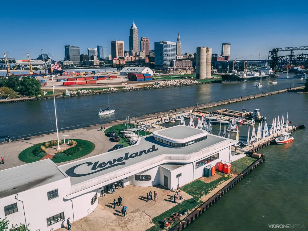
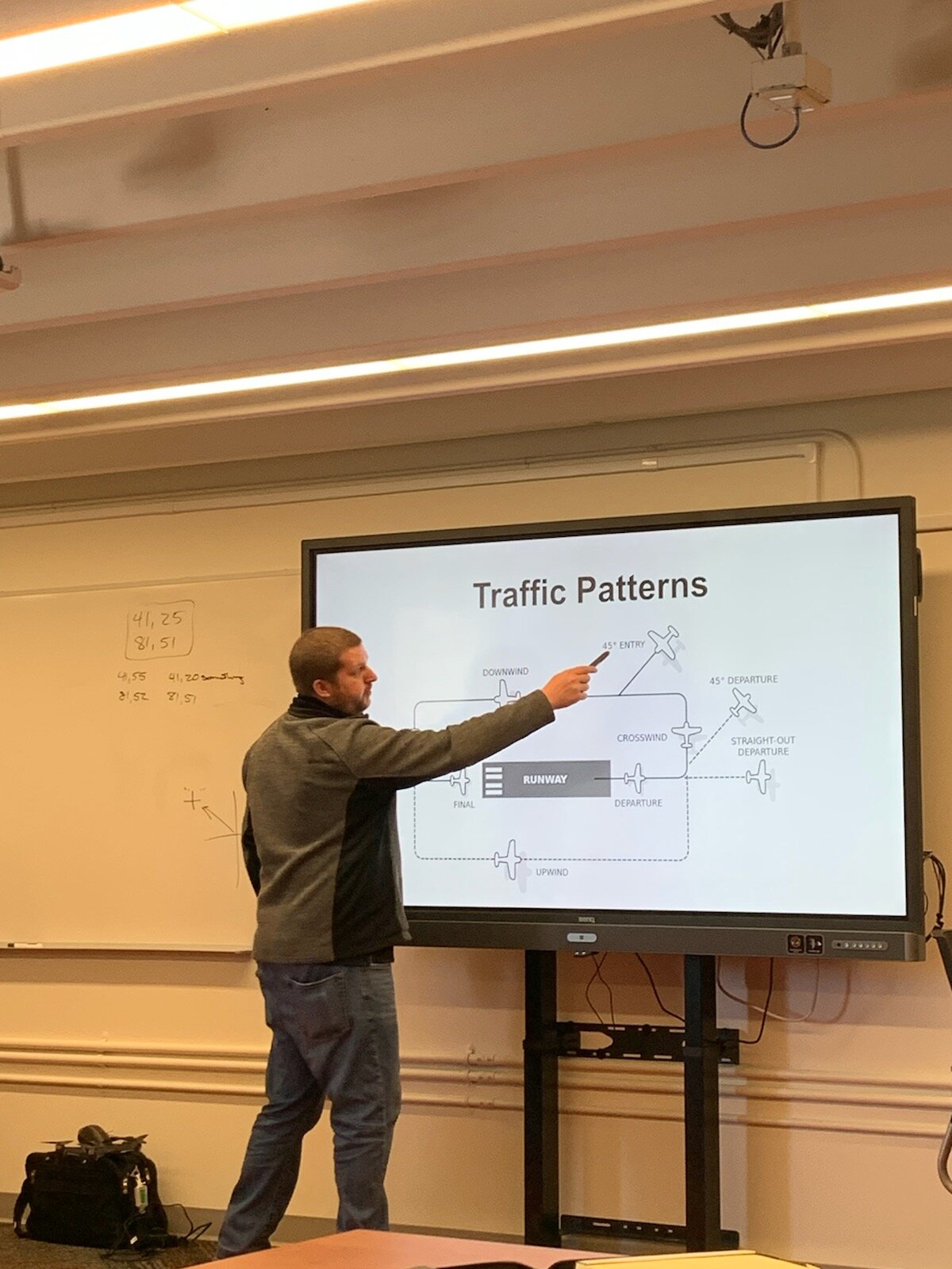
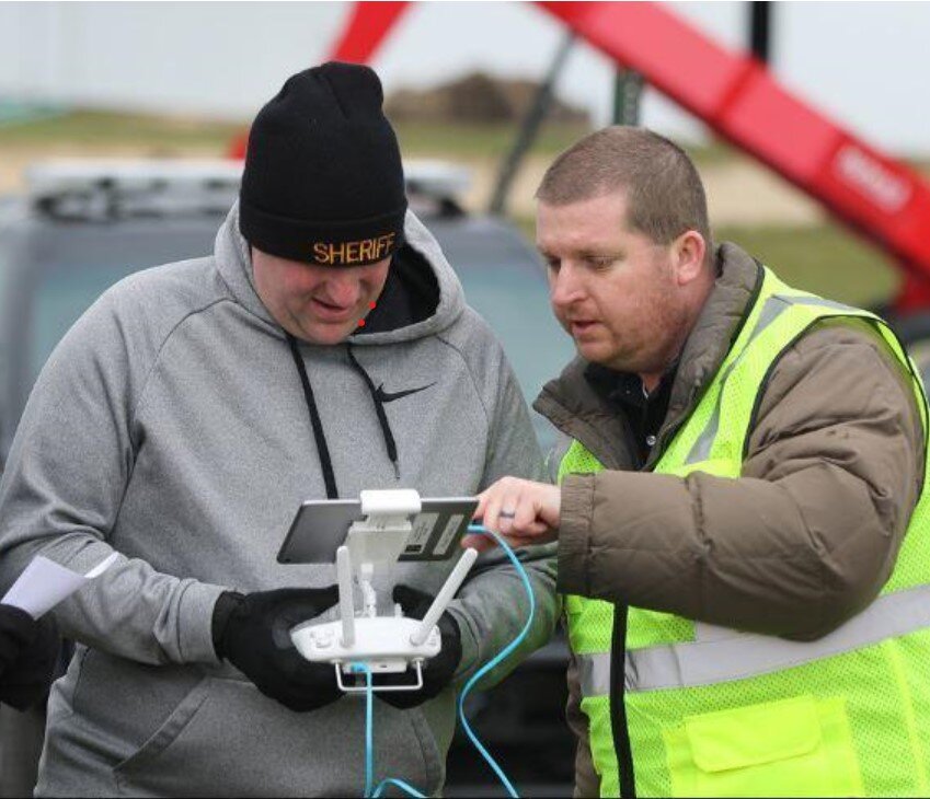
V1DroneMedia is owned and operated by its Chief Pilot Jason Damman, a professional airline turned drone pilot, with 25+ years’ experience in remote-controlled aviation, 20+ years in commercial airlines, and 5+ years in commercial drone operations. Jason is a drone and aviation practitioner and educator, performing complex drone jobs in various industries (see our Portfolio and YouTube channel for examples of our work), and is also a certified flight instructor, including training drone pilots.

Contact us for a consultation today. V1DroneMedia can help you complete a drone job, train your pilots, or help you to set up a drone operation of your own!


Where can I fly my drone?

I get this question all the time. Mostly when people see me fly my drone downtown Cleveland, Ohio, (and anywhere else). There is still a lot of confusion as to where you are legally allowed to fly.

There are 2 types of drone operators – hobbyists (recreational) and commercial operators (Part 107 license holders, like myself). As a reminder, drones are legally defined as aircraft, so their operations are subject to regulation by the FAA. This regulation applies to both recreational and commercial operations and ALL drone pilots are required to know the type of airspace they plan to fly in.

Commercial drone operators (with Part 107 certification) are required to learn and understand much more about operations within the NAS (National Airspace), and it is a major part of the FAA knowledge test for remote pilot certification. The same goes for the hobbyist drone pilots: as of 2021 they are required to take the TRUST test, preparation for which gives them basic information about the airspace types (see my TRUST test blog post for more information on that)

Types of United States National Airspace (NAS)

When planning a drone flight, you need to determine what type of airspace you are intending to fly in.  If it is controlled airspace (Class B, C, D, or certain areas of E) then you will need to get FAA authorization to fly in these areas.   Controlled airspace is typically found within 5 miles of an airport that has a control tower in operation. 

How can I check what type of airspace I am in?

There are several ways to check what type of airspace you are intending to fly in.  The easiest way is with an app that was developed in conjunction with the FAA, called B4UFLY. It provides drone pilots with a status indicator based on their current or planned location in relation to airspace restrictions. Of course, there may be additional restrictions, such as state and local regulations, that may not be shown on the app.

There are a variety of other apps available for drone pilots, including Airmap, UASidekick, and Aloft to name a few, which help determine the airspace type and the ability to request FAA flight authorizations through the app.

Uncontrolled airspace drone flight operations

As the name implies, you won’t need additional FAA authorization if you are in uncontrolled airspace. You are free to fly there, as long as you comply with basic drone operation rules (flying under 400’, not flying over people or traffic, and not interfering with traffic patterns of takeoff and landing areas, if near an airport).

How to get FAA Authorizations to fly in controlled airspace

If you’ve determined that you are going to be flying in controlled airspace (Class B, C, D, etc.) you must apply for an airspace authorization for altitudes below the posted UAS Facility Map grid altitudes (this applies to both recreational and commercial drone pilots)

You can get these authorizations through a variety of apps (mentioned above) that are LAANC (Low Altitude Authorization and Notification Capability) service providers, which were developed in collaboration with the FAA and the industry.

If you are unable to get authorization through the LAANC network, you will have to get authorization through the FAA DroneZone.

You can probably figure out where to go from here with the information and the links I provided, but if you want more detail and are more of a visual learner, I uploaded a video tutorial on getting drone flight authorizations through the LAANC and DroneZone on my V1DroneMedia YouTube channel.

Can I get an FAA Authorization through the DJI Fly Safe Website?

No, getting an FAA Authorization is a separate step from unlocking a DJI Fly Safe No Fly Geo Zone. I explain the difference and give the tutorial on how to unlock the DJI Fly Safe No Fly Zones in my What is DJI Fly Safe blog post.

Can I fly my drone downtown Cleveland?

If you are specifically looking to fly downtown Cleveland (since I am local, I will elaborate on this subject), you will most likely be flying in Class D (controlled) airspace. This controlled airspace exists due to Burke Lakefront airport being located in downtown Cleveland and encompasses a 5 miles radius around the airport.  You will need to check the LAANC system to determine if the specific spot you are looking to fly in is within that controlled airspace and if so, you will need to get an FAA authorization to fly there. Simple, right? 

Something else to be aware of when flying downtown Cleveland is the fact that there may be TFRs (Temporary Flight Restrictions) in effect – typically in effect if there is a Cleveland Indians game – TFR prohibits any drone flying during that time.

I have a few spots I tend to fly at often around Cleveland, and you can read my post Where To Fly Drones in Cleveland to learn where that is.

I hope you have a bit more clarity now about flying at your desired location. Comment here or on my YouTube video if you’ve found this helpful, and contact me if you have more questions or have a topic in mind that you’d like to learn more about. Have a safe flight!