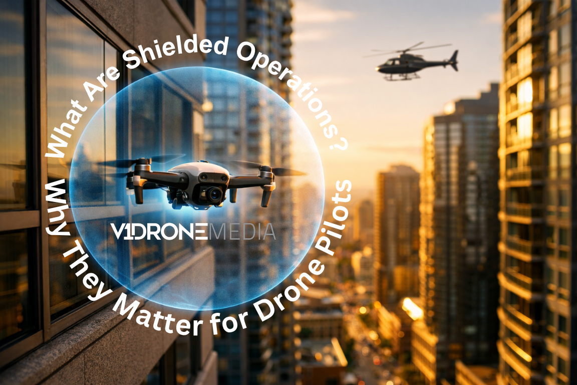
What Are Shielded Operations? (And Why They Matter for Drone Pilots in 2026)
If you’ve been following recent FAA updates—or hearing terms like BVLOS, Part 108, or DFR programs—you’ve probably come across something called “shielded operations.”
But what does that actually mean?
And more importantly:
👉 Does it change how you can legally fly your drone today?
Let’s break it down in plain English.
What Are Shielded Operations?
Shielded operations refer to flying a drone in areas where structures naturally block risk to other aircraft.
Think:
Near buildings
Under rooftops or overhangs
Along walls or inside urban corridors
The idea is simple:
👉 If a drone is flying in a space where manned aircraft physically cannot go, the risk of collision is dramatically reduced.
So instead of relying only on visual line of sight (VLOS) rules, the FAA is starting to recognize that: “The environment itself can provide protection.”
Simple Example of Shielded Operations
Imagine this:
You’re flying a drone along the side of a 5-story building
Your drone stays below the roofline
A helicopter physically cannot occupy that same space safely
That’s a shielded environment.
Now compare that to:
Flying 200 feet above an open field → NOT shielded
Flying over rooftops → NOT shielded
Why Shielded Operations Are Getting Attention Now
This concept is becoming important because of:
BVLOS (Beyond Visual Line of Sight) expansion
Drone as First Responder (DFR) programs
The upcoming Part 108 regulatory framework
Historically:
Under Part 107, most operations required visual line of sight
You needed waivers for anything beyond that
Some public safety agencies used:
COAs (Certificates of Authorization) → which allowed more flexibility, including limited BVLOS with extra paperwork
Now public agencies are transitioning toward:
COW (Certificates of Waiver) → which allows for BVLOS operations and is designed specifically to streamline public safety drone operations, allowing to scale DFR programs a lot faster
Now, the FAA is moving toward risk-based operations, where environment matters—not just distance.
Shielded Operations vs Part 107 Rules
Here’s the key distinction:
Under current Part 107:
You must maintain visual line of sight
BVLOS requires a waiver
There is no formal “shielded operations” rule yet
But…
The FAA is actively working toward rules where:
👉 Shielded environments may allow expanded operations without traditional BVLOS restrictions
This is where things are heading—not fully here yet.
Why This Matters for Commercial Drone Pilots
Even if the rules aren’t fully implemented yet, this is a big deal for your future as a pilot.
Shielded operations could unlock:
Safer urban drone inspections
More scalable construction monitoring
Expanded public safety response (DFR)
Reduced regulatory friction in cities
In other words:
👉 More real-world jobs become easier to execute legally
Shielded Operations and Public Safety (DFR Programs)
This concept is especially important in Drone as First Responder (DFR) programs.
In many cases:
Drones launch from rooftops
Fly along streets and buildings
Stay within shielded corridors
This allows agencies to:
Reduce risk to manned aircraft
Expand operational range
Respond faster to incidents
Shielded Operations can make BVLOS more practical for public safety agencies, but the waiver does not remove the need for operational discipline. Agencies still need documented training, SOPs, airspace awareness, crew coordination, go/no-go criteria, emergency procedures, and recurrent proficiency. Jason Damman, our Chief Pilot, explains this aviation-based approach in his Police1 article on strengthening Drone as First Responder programs.
Important: Surveillance Laws Still Apply (Example: Ohio HB 77)
Even as operations evolve, privacy laws still matter.
For example:
In Ohio House Bill 77, law enforcement must obtain a warrant for certain types of drone surveillance
So even if:
The flight is shielded
The operation is technically safe
👉 You still must comply withstate-level legal restrictions
How This Connects to Your Part 107 License
Here’s where most people get this wrong:
They jump ahead to advanced topics like BVLOS and shielded operations…
👉 …without mastering the fundamentals.
To even operate legally today, you still need to understand:
Airspace classification
Weather and visibility
Regulations under Part 107
Operational limitations
If you’re still preparing, start here:
👉 [How to Get Your FAA Part 107 License (2026 Guide)]
What You Should Focus on Right Now
If you're a new or aspiring drone pilot:
1. Get your Part 107 certification
This is your foundation—non-negotiable.
2. Understand current rules (not future ones)
Shielded operations are coming—but you still operate under Part 107 today.
3. Practice real-world scenarios
You need to think like a pilot, not just memorize answers. Hands on flying is the foundation of becoming a professional drone pilot. Practicing those flying skills in real world scenarios will make you proficient and ready for a real mission.
If you you are not proficient with hands on flying yet, start practicing. There is no substitute for experience here.
👉[Check out our Hands On Drone Operations Course]
Train for the Real Test (and Real Flying)
If you’re studying right now, this is where most people struggle:
They memorize questions
But don’t understand why
That’s exactly why we built our system:
300+ FAA-style questions
Real 65-question test simulations
Study guides tied directly to each concept
Progress tracking so you know when you're ready
👉 [Try the Part 107 Practice Test System]
The Bottom Line
Shielded operations are part of a bigger shift in drone regulations:
➡️ From rigid rules
➡️ To risk-based operations
But today:
If you are a commercial operator (not a public safety agency) and fly under Part 107 you cannot fly under BVLOS or Shielded Operations without additional waivers
If you fly under Part 107 and are public safety agency, you may be eligible to apply for Shielded Operations or fly BVLOS under Part 91
If you’re exploring a right path for your department’s Drone as a First Responder program or if your agency is evaluating Shielded Operations, the first question is not just “Can we get approved?” It is “Are we ready to operate safely, consistently, and defensibly once approved?”
👉 Request DFR & Shielded Operations Support
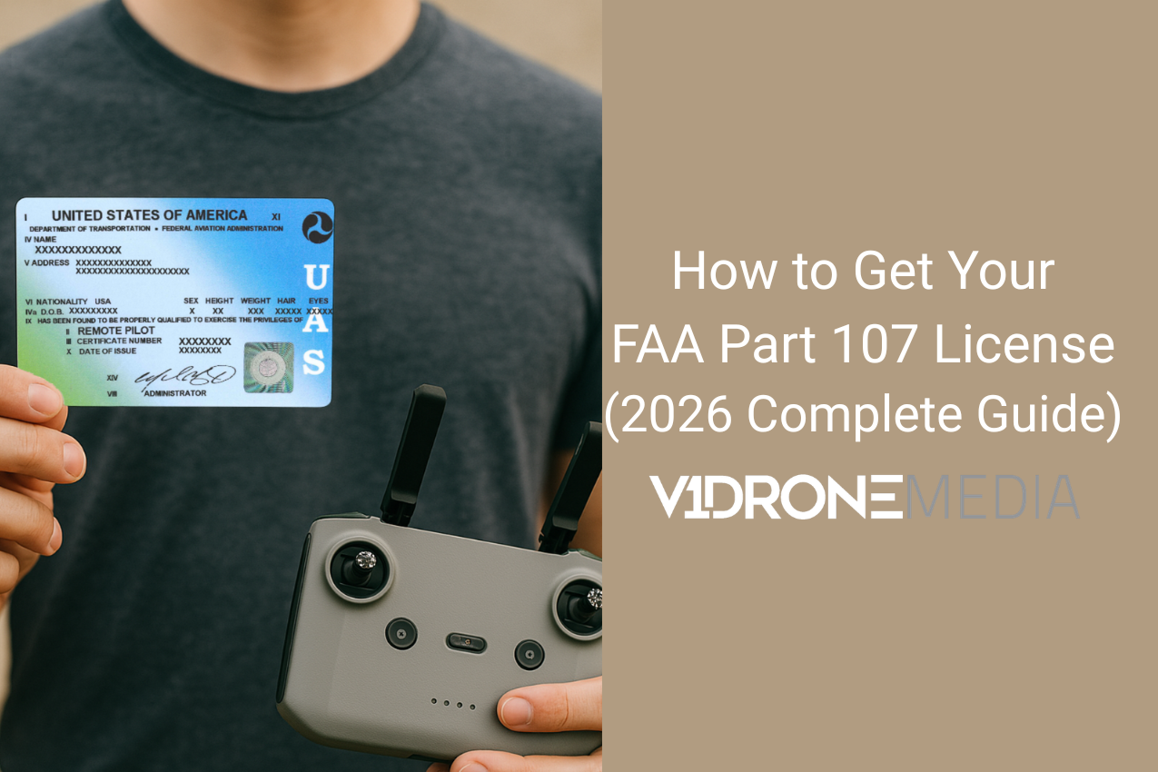
How to Get Your FAA Part 107 License (2026 Complete Guide)
If you want to fly a drone commercially in the United States, you need an FAA Part 107 license.
That includes real estate photography, construction progress, inspections, marketing videos, public safety operations, and any situation where money is involved, even if you are flying the drone to promote your business or your blog. The drone industry is all the buzz right now, as the opportunities are abundant - you can learn more about it in our blog post Careers in the Drone Industry.
We teach Part 107 prep in person in Cleveland, Ohio, to general public and train public safety agencies nationwide. After working with hundreds of students, we can tell you this clearly:
The Part 107 test is very passable. But it requires structured preparation.
Here is exactly how the FAA Part 107 test works and how to pass it the first time.
What Is the FAA Part 107 License?
The Part 107 Remote Pilot Certificate (aka drone license) is issued by the Federal Aviation Administration (FAA). It allows you to operate a drone for commercial purposes under 14 CFR Part 107 regulations.
There is no online version of the actual FAA exam. You must take the test in person at an approved PSI testing center.
Once you pass the knowledge test, you apply for your Remote Pilot Certificate through the FAA system.
Where Do You Schedule the FAA Part 107 Test?
The FAA Part 107 exam is a proctored, in-person test. That means it is supervised at an official testing center. You cannot take it at home.
All Part 107 knowledge tests are administered through PSI, the FAA’s approved testing provider.
To schedule your exam, you will:
Create an FAA Tracking Number (FTN) through the Integrated Airman Certification and Rating Application system (often referred to as IACRA).
Visit the PSI testing website.
Search for a testing center near you.
Select a date and pay the testing fee, which is typically around $175.
Testing centers are located throughout the United States, often inside small airports, aviation schools, or professional testing facilities.
If you are ready to schedule, you can find official testing locations and register directly through the PSI FAA Airman Knowledge Testing page.
It is important to schedule only after you are consistently scoring well on full-length practice exams. The exam fee is non-refundable, and rescheduling can delay your certification.
What Is on the Part 107 Test?
The FAA Part 107 test includes:
60 multiple choice questions
2 hours to complete the exam
A minimum passing score of 70 percent
The exam covers several core knowledge areas:
Airspace classification
Sectional charts, which are aviation maps that show controlled and uncontrolled airspace
Weather reports including METAR (Meteorological Aerodrome Report, which shows current airport weather conditions)
TAF (Terminal Aerodrome Forecast, which provides forecasted weather conditions)
FAA regulations
Airport operations
Loading and performance
Emergency procedures
Aeronautical Decision Making, often shortened to ADM
Many students find the airspace classifications and weather sections the most technical. You are expected to interpret real aviation charts and decode real weather reports, not just memorize definitions. The FAA states, "Unless you have been flying drones for some time or have previously taken the knowledge test, you will need to spend time studying for the exam”. Aviation knowledge isn't something most people use daily, so you face a steep learning curve.

Example of an aviation sectional chart you will have to learn to read and answer questions on
Is the Part 107 Test Hard?
Part 107 Test is similar to a private pilot aeronautical exam for manned aviation. The difficulty depends entirely on how you prepare, and if you have any prior aeronautical knowledge.
Students who struggle usually rely only on videos or passive reading without realistic practice tests. Others practice random questions without ever taking a full-length timed simulation.
The FAA exam does not just test knowledge. It tests your ability to apply regulations, interpret sectional charts, and decode weather reports under time pressure.
That is why studying these complex topics is important, and realistic practice exams matter. The mode you choose to study and practice is completely up to you, but each available method (self-study, online course or in-person) has different pros and cons, as well as the costs associated with it.
👉 For a full breakdown of study study options, read:
FAA Part 107 Online Course vs In-Person: Which Actually Gets You Licensed?
How Many Times Can You Take the Part 107 Test?
If you fail the Part 107 test, you must wait 14 days before retaking it.
Each attempt costs approximately $175 depending on your testing center.
Failing is not catastrophic, but it is expensive and frustrating. It can also affect confidence. The better approach is to confirm you are ready before scheduling your exam.
What Score Should You Aim for Before Booking the Exam?
The FAA requires 70 percent to pass. But 70 percent should not be your goal.
We recommend students consistently score at least 85 percent on full-length Part 107 practice exams before scheduling the real test. That number comes from real classroom experience. Students who score in the mid 80s or higher walk into the testing center calm and prepared. Students sitting around 70 percent often second guess themselves.
Seventy percent means you barely passed. Eighty five percent means you understand the material.
That is why we built the 85 percent benchmark directly into our Part 107 Practice Test system. The Exam Readiness Tracker monitors your full-length test scores and confirms when you are consistently performing at or above that level. Instead of guessing when you are ready, you have measurable proof.
Save $10 on Full Part 107 Practice Test Access
Before you spend around $175 on the real FAA exam, make sure you are actually ready.
Use code SPRING26 to save $10 off any plan on the full Part 107 Practice Test system, including timed exam simulations, 300+ FAA-style practice questions, weak-area tracking, study guides, and the Exam Readiness Tracker.
Start with the free 15-question demo, or use the coupon when you are ready to unlock the full system.
Unlock Full Access & Save $10 Now
There is a big difference in how confident you feel walking into a PSI testing center when you know your scores are consistently strong.
How Much Does It Cost to Get a Part 107 License?
Before you move forward, it’s important to understand the total cost involved.
At a minimum, you’ll need to pay for the FAA knowledge test: FAA Test Fee: approximately $175
Beyond that, your total cost depends on how you choose to prepare.
Some candidates spend nothing on study materials and rely entirely on free resources. Others invest in online courses or in-person training programs, which can range from $150 to $500 or more.
There is also a factor many people overlook: time.
If you are getting certified for professional use — whether in media, construction, inspections, or public safety — the time it takes to prepare can directly impact your ability to start working or take on new opportunities.
A more efficient study approach can reduce both cost and time to certification.
👉 For a full breakdown of all costs, study options, and the most efficient way to prepare, read:
How Much Does a Part 107 Drone License Cost? (Full Breakdown)
The Best Way to Study for the FAA Part 107 Test
After teaching individual students and public safety agencies, here is what works consistently:
Learn the material in structured categories.
Practice with realistic FAA style questions.
Take full 60 question timed exams.
Identify weak areas and focus study time there.
There are several well-known Part 107 online courses available, including Pilot Institute, Sporty’s, and King Schools. These programs are primarily video-based training courses that walk you through the required knowledge areas and typically include practice quizzes or sample tests.
For many students, a structured video course is a helpful starting point. If you are disciplined with self-study and comfortable learning independently, that format can work well. But not everyone learns best by watching videos alone.
Some students realize partway through self-study that they need more interaction, clearer explanations, or the ability to ask questions in real time. That is where in-person instruction can make a real difference. We run live Part 107 prep classes in Cleveland three to four times per year for students who prefer classroom learning and direct guidance through charts, weather interpretation, and regulations. If you want live instruction are willing to travel to Northeast Ohio, you can check our upcoming class dates .
Regardless of how you learn the material, there is still a separate skill that determines success on test day: performing under exam conditions.
That is why we built our Part 107 Practice Test system specifically around realistic simulation and performance improvement. Instead of just offering additional practice questions, the system identifies weak categories, builds focused practice sessions around those areas, and links directly to targeted study guides tied to the exact topics you are missing.
Students can:
Take realistic 60 question timed simulations that mirror the FAA format
Take advantage of 300+ randomized FAA-style questions in practice and in test mode
See category breakdowns to identify weak topics
Use a Focus on Weak Areas feature that automatically builds practice sessions around categories below 70 percent
Jump directly from missed questions into the relevant study material
View sectional charts and official FAA figures directly inside the testing interface
Track score trends over time and confirm consistent 85 percent readiness
The goal is not just to consume information. It is to practice in a way that measurably improves your score.
When students combine structured learning with focused exam simulation, their readiness becomes clear. And that clarity is what leads to confident performance at the testing center.
Try a Free 15 Question Part 107 Practice Test
If you are not ready to commit to a full practice exam, start with our free 15 question demo.
It works like a scaled-down version of the full simulator. You will experience FAA-style questions, view sectional charts and official FAA figures directly inside the test interface, and receive immediate explanations for each answer.
The demo allows you to:
Understand how Part 107 exam questions are structured
See how aviation charts are presented and interpreted
Get instant feedback on your performance
After finishing, you will see your score and topic breakdown.
If you decide to continue, the full system includes complete 65 question timed simulations, focused practice sessions built around weak categories, integrated study guides, and the Exam Readiness Tracker that confirms consistent 85 percent performance.
You do not need to commit immediately.
Start with the 15 question test drive.
See where you stand.
Then decide your next step.
👉 Try the Free 15 Question Part 107 Practice Test
For First Responders and Agencies
Departments training multiple drone pilots need more than just exam prep.
They often require structured classroom instruction, clear regulatory understanding, scenario-based discussion, and operational readiness guidance.
We provide nationwide Public Safety Agencies group instruction for Part 107 certification, DFR & Shielded Ops program consultation & documentation help, as well as basic and advanced scenario-based first responder drone training and program development support.
If you are coordinating drone training for a department, contact us directly to discuss group training options.
Final Advice Before You Schedule Your FAA Part 107 Test
Do not schedule your exam based on how confident you feel.
Schedule it when:
You can complete 60 questions comfortably within two hours.
You consistently score above 85 percent on full-length practice exams.
You understand why answers are correct, not just which ones are correct.
That is when you are actually ready.
And if you are unsure where you stand today, start with the free 15 question demo and measure your readiness before you spend money on the real exam.
From Novice to Pro: The Essential Winter Drone Survival Guide
Operating drones in winter presents several challenges, many of which users commonly complain about. These issues can significantly impact both recreational and commercial drone operations during cold or hazardous weather conditions. Here are some of the most frequent issues that drone pilots encounter during winter months:
1. Battery Performance
Complaints: Batteries drain faster in cold weather due to reduced chemical reactions in lithium-ion cells. This is particularly noticeable when temperatures drop below freezing, as the chemical processes that generate electricity become significantly slower.
Impact: Reduced flight time and the need to carry extra batteries or cut missions short. Some pilots report flight times being reduced by up to 50% in extremely cold conditions, which can severely impact planned operations.
Suggestion: Ensure batteries are at room temperature before operation (at minimum 60-65°F or room temperature). Consider using battery warmers or insulated cases during transport. Once flying, the battery will generate some heat on its own, but you should expect shorter flight time. Carry extra charged batteries to counter this issue, and always monitor battery levels more frequently than in normal conditions. Read more about Maximizing Drone Battery Life regardless of weather conditions.
2. Ice and Snow Accumulation
Dangers of Icing in Winter Drone Operations YouTube Video on V1Dronemedia YouTube channel - click to watch!
Complaints: Snow or ice can accumulate on propellers, sensors, and the camera, affecting flight stability and image quality. This accumulation can happen rapidly, especially in wet snow conditions.
Impact: Icing buildup on the propellers, making them less efficient or destroying lift altogether, leading degraded performance or potential crashes. Even small amounts of ice can significantly affect aerodynamics and control.
Suggestion: Do not fly your drone during significant snow or during icing conditions. Drones do not have de-icing solutions like some airplanes do, so you risk losing your drone if you choose to fly it. If you must fly in light snow, regularly inspect the drone for any ice buildup.

My drone propeller with icing accumulation
3. Signal Interference
Complaints: Cold temperatures and atmospheric conditions, like snowstorms, can interfere with GPS and remote-control signals. Winter weather patterns often bring increased electromagnetic interference.
Impact: Loss of control or poor GPS lock, leading to unstable flights or difficulty with automated features. This can result in erratic behavior or complete loss of drone control.
Suggestion: As mentioned before, don't fly your drone during significant snow or during icing conditions. Certainly, do not fly in snowstorms or a hurricane, as you risk losing your drone. When possible, maintain a closer operating distance and ensure clear line of sight.
4. Condensation Issues
Complaints: Transitioning between cold outdoor temperatures and warm indoor spaces can cause condensation on the drone's electronics or camera lens. This is particularly problematic when moving quickly between temperature extremes.
Impact: Potential damage to internal components or blurred footage. Moisture can lead to short circuits and corrosion over time.
Suggestion: This is a common issue for any equipment with a camera, and it isn't something that is avoidable or fixable. Just something you should be aware of, and that it can interfere with getting good quality footage or imagery. Allow gradual temperature transitions when possible.
5. Reduced Visibility
Complaints: Fog, snow, and shorter daylight hours reduce visibility, making it harder to navigate or capture clear images. Winter conditions often create challenging lighting situations.
Impact: Safety concerns and lower-quality footage. Reduced visibility can make it difficult to maintain visual line of sight, which is required by regulations.
Suggestion: Don't fly in poor visibility conditions. Your footage quality will be poor, and you risk losing your drone. Plan flights during optimal daylight hours and monitor weather forecasts carefully.
6. Cold-Induced Fragility
Complaints: Plastic and other materials on drones may become brittle in low temperatures, increasing the risk of cracking or breaking on impact. This affects both the drone body and accessories.
Impact: Shortened lifespan of parts or the need for repairs. Even minor impacts that wouldn't normally cause damage can result in breaks during cold weather.
Solution: Minimize the time exposure of your drone to the cold. Store the drone in insulated cases when not in use and consider using additional protective gear during flights.
7. Pilot Comfort
Complaints: Operating a remote controller with gloves is cumbersome and presents significant challenges for drone pilots in cold weather. Traditional winter gloves are often too thick for precise control inputs, while removing them exposes hands to harsh temperatures. This creates an uncomfortable dilemma where pilots must choose between warmth and control accuracy. Even thin gloves can interfere with touch-sensitive controls and buttons, making smooth operation difficult.
Impact: The reduced dexterity and sensation when wearing gloves can lead to imprecise control inputs, potentially affecting flight safety and camera operations. Cold hands can cause trembling and reduced finger mobility, making it challenging to execute delicate maneuvers. These issues often force pilots to cut their flying sessions short, limiting productive flight time and potentially compromising planned operations or photography sessions.
Suggestion: Through personal experimentation, I've found several solutions to this common challenge. The most effective option has been investing in a specialized remote control "glove" or "mitten" designed specifically for drone controllers, similar to this listing on Amazon. Additionally, I sometimes opt to operate from inside my vehicle when conditions are particularly harsh, though this approach may not suit everyone's comfort level or flying style. The key is to experiment with different solutions until you find what works best for your specific needs and flying conditions.
9. Wind Challenges
Complaints: Winter often brings strong and unpredictable winds, making drones harder to stabilize. These gusty conditions can be particularly challenging in open areas or near buildings where wind tunnels form. The cold air density also affects drone performance differently than warmer conditions, requiring more power for the same maneuvers and potentially reducing flight time.
Impact: Higher risk of crashes and less smooth footage becomes a significant concern during winter operations. Wind gusts can suddenly push drones off course, making precise positioning difficult and potentially leading to collisions with obstacles. Camera stability is notably compromised, resulting in shaky footage that may be unusable for professional work. Battery performance can also degrade faster when fighting against strong winds, shortening already reduced flight times in cold conditions.
Suggestion: Winds affect different drones differently. It depends on the size, weight, and overall structure of the drone. Larger, heavier drones typically handle wind better than lighter models, but they consume more power in challenging conditions. Best practice would be to follow manufacturers' guidelines, of course! It should be noted in the user manual of the drone. Most manufacturers provide specific wind speed limitations and recommended operating conditions for optimal performance and safety.
Some drone enthusiasts and professionals adapt to harsher conditions by using specialized gear (waterproof drones are not on my list because they are not practical or affordable for the majority of drone operators), or by limiting their operations to milder weather days. I opt for the latter, as it provides the safest approach while preserving equipment longevity.
Overall, drone operations depend on the weather conditions, and since they are even more challenging in the areas that get snow and icy conditions in the winter, I fly my drone much less in the winter and in the rainy spring and fall seasons since I am located in the Midwest (Cleveland, Ohio). The combination of wind, precipitation, and cold temperatures creates a particularly challenging environment that requires careful consideration of safety and equipment limitations.
I hope you find this blog post useful. As usual, reach out to me with any questions, comment below, join our drone training newsletter for drone training class updates, new blog posts or YouTube video notifications.

Maximizing Drone Battery Life: Essential Care Tips for LiPo Batteries
In this comprehensive guide, we'll delve deep into the world of LiPo batteries, exploring essential care tips to maximize their lifespan and optimize your DJI drone's performance. We also have a YouTube Video on this topic for those who prefer visual learning.
Are you a passionate drone pilot like me who is a drone hobbyist or a drone professional who uses drones almost daily, and has spent a fair amount of money on drone equipment over the years, including batteries? I fly drones for a living now, and my biggest concern is to have equipment that I can rely on during a professional shoot, which I want to conduct in the most efficient and productive manner. So, if you're an owner of DJI drones like me (Inspire, Mavic Pro, Mini, Phantom series, etc.), you know that your drone's performance heavily relies on its LiPo (Lithium Polymer) batteries. These batteries power your drone flights, but they aren't immortal. As the battery's capacity decreases, the runtime of devices that use the battery will be reduced and the battery will eventually need to be replaced. Since my goal as a drone pilot and a business owner is to maximize my drone flight time per battery, and minimize my battery replacement cost, prolonging the life of the batteries is of utmost importance to me.
In this comprehensive guide, we'll delve deep into the world of LiPo batteries, exploring essential care tips to maximize their lifespan and optimize your drone's performance. We also have a YouTube Video on this topic for those who prefer visual learning.
Understanding LiPo Drone Batteries
LiPo batteries have transformed the drone industry, thanks to their outstanding energy density. These batteries excel at storing a significant amount of energy in a lightweight and compact package. This incredible power-to-weight ratio makes LiPo batteries the perfect choice for powering DJI drones. Whether it's capturing stunning aerial shots, performing rapid ascents, or compensating for challenging weather conditions during flight, LiPo batteries are the backbone of your drone's capabilities.
Fun Fact: LiPo batteries can typically endure between 200-400 charge cycles if they receive proper care.
Factors Affecting Drone Battery Life
To ensure your DJI LiPo drone batteries remain in prime condition and serve you faithfully for an extended period, it's essential to understand the various factors that can influence their lifespan:
Overcharging/Over Discharging
Arguably the most critical aspect of LiPo battery care is avoiding overcharging or leaving your batteries fully charged for prolonged periods. Overcharging places undue stress on your batteries, leading to capacity loss and potential safety hazards. To maintain optimal battery health, it's crucial to store your LiPo batteries at around 50-60% charge in a cool, dry environment.
Monitoring Cell Voltage
Modern DJI drones are equipped with advanced technology that allows you to monitor individual cell voltages through the DJI GO flight app. This feature empowers you to land your drone promptly if any cell voltage approaches an unsafe level, ensuring the longevity of your batteries.
Smart Batteries
DJI's "smart batteries" come equipped with technology that monitors various battery parameters, such as temperature, voltage, and capacity. While these built-in safeguards enhance safety, they should never be fully trusted. It's imperative never to leave LiPo batteries unattended while charging to mitigate potential failures.
Overheating/Over Cooling
Extreme temperatures can wreak havoc on your battery's internal components and pose safety risks. For optimal performance, ensure your batteries are at the right temperature (around 70 degrees Fahrenheit or 21 degrees Celsius) before launching your drone. This is particularly critical when flying in cold weather.
Physical Damage
Batteries displaying any signs of physical damage, such as punctures, swelling, or cracks, should never be used. Such damage compromises the integrity of the battery's internal components and heightens the risk of accidents.
Safe Storage
For safe storage, always keep your LiPo drone batteries in a cool, dry place away from flammable materials. Consider investing in a fireproof container designed explicitly for battery storage to enhance safety further.
For those who prefer visual learning, here's an informative YouTube VLOG that delves deeper into the topic of maximizing drone battery life:
Essential tips to maximize the lifespan of your DJI drone Lipo batteries
Advanced Tips for Extending Drone Battery Life
If you're a committed drone pilot looking to take your battery care to the next level, consider implementing these advanced tips:
Optimize Charging Practices
Select a charger explicitly designed for LiPo cells when charging your batteries. Avoid using chargers not meant for LiPo batteries, as they can lead to overcharging and other issues.
Battery Maintenance
Incorporate regular battery inspections into your routine. Even if your batteries appear to be functioning correctly, early detection of issues can prevent more significant problems down the line.
Storage Voltage
For extended storage periods, maintain your batteries at a storage voltage of around 3.8 volts per cell. Many DJI drones offer a storage mode that automatically sets the batteries to this level.
Transportation
When traveling with your drone, always remove the batteries and transport them in a fire-resistant bag explicitly designed for LiPo batteries. This extra precaution can mitigate risks during transportation.
Manufacturers' Guidelines
Always adhere to the manufacturer's guidelines and recommendations regarding battery care and usage. These guidelines are meticulously crafted to ensure safety and optimize battery life.
Battery Cycle Management
Keep meticulous records of the number of charge cycles each of your LiPo batteries has undergone. This knowledge will help you plan for replacements as batteries approach the end of their lifespan.
Conclusion
Your DJI LiPo drone batteries are more than mere power sources; they are key to the reliable performance of your drone while capturing breathtaking aerial shots and should be cared for accordingly. By understanding their characteristics, and limitations, and diligently following the tips and best practices outlined in this guide, you can significantly extend the life of your batteries.
Maximizing drone battery life isn't just about saving money on replacements; it's also about ensuring the safety and reliability of your drone flights. With proper care, your LiPo batteries can serve you faithfully for several years, delivering countless hours of flight time, capturing unforgettable experiences, and increasing your drone business customer satisfaction.
I hope you found this drone battery care guide helpful, consider commenting, subscribing to our Drone Training newsletter, and following us on YouTube and Instagram channels. If you are in the Cleveland, Ohio, area keep an eye on drone meetups for North Coast Drone Alliance which I also attend as one of the board members and founders, during which members share their drone experiences and tips, and come together to fly at local parks.

How to Build a Business Case to Use Drones in Your Construction, Engineering, or Architecture Operations
So, you've heard and read that drones are being increasingly used in the construction industry to realize multiple benefits: they are utilized to complete some tasks in commercial real estate development and construction workflows faster, cheaper, safer, and in many cases, more accurate than using traditional methods. The latest construction industry reports show that drone use cases in construction are expanding, and the number of flights is increasing.
At this point, you may be already convinced that bringing drones, or at least testing the inclusion of drones in your operations is the right thing to do. The main problem you are facing is that you know that trying this technology will take additional resource allocation from your organization (it may be time, budget, manpower, or all the above). And if you don't control any of these resources but see the opportunity and are eager to bring this to your managers, you will need to build a business case and present it to your superiors.
At the end of the day, you also want to keep yourself relevant and further your career in your organization or even create a new position job for yourself, so proposing using cutting-edge technology to make your company's operations more efficient will promote your reputation as forward-thinking and innovative. If you do control the decision-making and resources in your organization, you can contact V1DroneMedia today, and we can help you find the right drone solution and help incorporate drones into your operations.

Building a business case
Steps on how to build a business case to incorporate drones into your operations:
1. Understand the gaps that your organization must fill to build up this capability. They are:
· Knowledge of national airspace regulations to gauge your ability to fly at any given site (resource allocation and cost – can be a drone pilot or drone operations manager)
· Part 107 licensed staff or contractors that can legally and skillfully operate drones to accomplish required tasks (staff allocation and training cost, or cost to hire pilots)
· Purchase drones that are suitable for your use cases (know-how and the cost)
· Drone equipment maintenance (know-how and the cost)
· Purchase Drone Insurance (unless your pilot contractors have it and can add your organization as an additional insured)
· Establish Drone Operating procedures on work sites
· Photogrammetry software (cost to purchase, human resources, and the know-how to process the data)
2. Establish use cases in current workflows that can bring value to your organization and translate them into cost savings, a competitive advantage, new added value, or other benefits.
See our blog posts Photogrammetry, Top 4 Drone Uses in Construction, Drone Use in Construction Marketing, Drone Mapping: Unleashing the Full Potential of Aerial Data, What is Drone Mapping, and Drone Mapping Advantages vs. Conventional Mapping Methods for information on a variety of ways to incorporate drones into your operations. Benefits of these use cases include, but are not limited to:
· Saving time in accomplishing tasks faster (translate that into saving $ as well)
· Providing more accurate data for some use cases (translate into $ savings)
· Potential for safety increase (can be one of the organizational goals, or translate it into insurance savings, or other $)
· Add new value to your operations (translate that into a new product/service offering as a new stream of revenue, new customer benefit to differentiate you from the competition, etc.)
3. Establish a budget range and other resources (like labor) necessary to acquire this capability.
You will also have to decide if you want to grow this capability from within, or outsource the data gathering and processing – i.e. Make or Buy decision)
4. Run financial analysis with multi-year scenarios to show the Return on the Investment (ROI) of implementing drone technology into your workflows
5. Develop a business case presentation that includes:
· Industry trends with drone adoption data
· Case studies of organizations that have adopted this technology (for example, see the article Ohio Department of Transportation Makes a Good Case for Their Drone ROI)
· Pros/cons of not adopting drones
· Outline your plan to build this capability for your organization
1. How your organization will use the drones
2. How drones will incorporate into workflows
3. What resource investment is required (budget and timeline for labor, hardware, software, insurance, etc.)
4. Financials with ROI. If you didn't have a financial professional from your workplace develop this model, make sure you can explain your assumptions. I recommend bringing a trusted finance team member on board to help you make the business case with concrete numbers
5. Present risks of adopting drones into your organization and plans to mitigate them
6. Finally, present your business case to your decision-makers.

Present your drone use business case
We hope you found this step-by-step guide on building a business case to include drones in your operations valuable.
V1DroneMedia is a Cleveland-based drone services company that was founded by an airline pilot with a background in remote control aviation and electrical engineering, and a marketing professional who has a couple of decades of experience in developing and pitching business cases to leadership (read more about V1DroneMedia here).
If you are looking for a consultant to help you include drones into your operation, help you train your employees to fly drones, build a business case, or are looking to outsource drone flying to a reputable company, contact us today, and learn more about our AEC Drone Services.

DJI Mavic 3 Waypoints: definition and flight planning tutorials.
The drone community has been wondering for a long time: will Mavic 3 consumer drones have waypoints as an option? Finally, on December 9th (an early Christmas present to all of us drone pilots), DJI released a firmware update in the DJI Fly App, which included waypoints.
What are Waypoints
Waypoints are points (or stops) on a route or line of travel that can be used to program a drone where to fly. Waypoint missions for drones also allow for setting altitude, speed, and gimble tilt among many other things. Using waypoints to plan where/how a drone will (and what you would like the drone to do) fly is like having an autopilot for your drone.
Why is it important to have waypoints on a drone?
Creating (and saving) waypoint missions allows a drone to repeat the same flight path without having to try to recreate the flight manually every time. This allows for replicating a shot for video purposes or taking photos from the same point in space (lat/long and altitude), say, for a construction project.
Waypoints have uses in a variety of tasks, ranging from aerial video production to drone mapping. Here are a few ways we have used them when providing drone services to our clients:
1. Re-creating the same video shot. Very useful if you use your drone for video production where you must do several takes that need to look exactly the same (usually a must for any type of commercial video work such as shooting a commercial, or on a TV or Film production set)
2. Creating a hyper lapse video that allows showcasing changes in the environment quickly, but in reality, these shots are taken during different times (seasons) of the year along the same path of flight and are later stitched together to quickly show changes of the site over time making it look seamless.
3. Capture photos of subjects and objects from the same vantage point repeatedly.
4. Program the flight path to create a map of a site or create a video of a pre-determined path.
Previously we have programmed our other DJI drones to fly on an automated path (Phantom 4 Pro or Mavic 2 Pro) using the Litchi app. We have created hyper lapses for our company's social media content and for construction progress monitoring videos and photos for our clients, as well as programmed automated flight paths for commercial video production shoots.
The fact that DJI released the waypoints with the firmware update for Mavic 3 makes this drone a lot more useful (previously you couldn’t even use Litchi to program the waypoints with the Mavic 3 because DJI has not yet released an SDK (Software Development Kit) allowing it to be used with third-party applications.
Which DJI Mavic 3 drones support waypoints?
All DJI Mavic 3 Drones now support waypoints through the DJI FLY app (DJI Mavic 3 Classic, Mavic 3, and Mavic 3 Cine).
How to use DJI Mavic 3 Waypoints: 2 ways with step-by-step tutorials
In order to use the new waypoints feature with the DJI Mavic 3 you must be on the latest firmware (aircraft, remote, and DJI Fly app) that was released on December 9, 2022.
There are a couple of methods that can be used in order to create a waypoint mission:
1) Create the waypoint mission as you fly your drone to where you want the waypoints to be – this requires the drone to be powered on and in flight.
2) Pre-planning a waypoint mission with the DJI Fly App – this can be done without even powering on the drone and before you even arrive at the site you intend to fly!
We have created a video detailing a step-by-step process for both workflows. Our waypoint video tutorial also includes an overview of waypoint settings and customizations and shows some examples of missions we have set up, and the drone flying them. We also cover how you can save your waypoint missions in order to use them again at a later date/time.
Watch this video to learn a couple of different ways to program your DJI Mavic 3 Drone waypoints, download the firmware update, and start practicing creating waypoint missions! Happy flying, and please subscribe to our channel if you find this useful and would like to get updated when new tutorials and other informative content coming out!
We hope you found this video tutorial useful. Browse more content on our YouTube channel and Blog, and subscribe to those resources, and check out more of our channels to see more useful content in the future.
V1DroneMedia is a drone services provider in the Cleveland, Ohio, area. We provide aerial photography, videography, photogrammetry (drone mapping, 3D modeling), and full video production services. V1DroneMedia Chief Drone Pilot, Jason Damman, is also an airline pilot with 20+ years of aviation experience and is a drone flight instructor at several educational institutions, besides running his own drone classes with groups and individuals. We service Ohio, and other Midwest states, and can travel to other areas as needed.
Contact V1DroneMedia for your drone services, drone training, or video production needs!

What is DJI Fly Safe? Is unlocking a Geo Zone in DJI Fly Safe the same as getting an FAA Authorization?
I am a commercial drone pilot, drone services provider, and drone educator based in Cleveland, Ohio, and I get a lot of questions concerning drone operations from drone hobbyists, drone training students, and those that read and watch my drone education content. Recently I noticed that there is some confusion concerning DJI Fly Safe Geo Zone Unlocks to remove flying restrictions that prevent the aircraft to fly vs. getting an FAA Authorization to fly in controlled airspace.
I am a commercial drone pilot, drone services provider, and drone educator based in Cleveland, Ohio, and I get a lot of questions concerning drone operations from drone hobbyists, drone training students, and those that read and watch my drone education content. Recently I noticed that there is some confusion concerning DJI Fly Safe Geo Zone Unlocks to remove flying restrictions that prevent the aircraft to fly vs. getting an FAA Authorization to fly in controlled airspace.
In this blog post I explain the following:
· What DJI Fly Safe is
· How unlocking DJI Fly Safe Geo Zones differs from getting FAA Authorization to fly in a certain airspace
· Clear up the confusion between unlocking DJI Fly Safe Geo Zones vs. getting an FAA authorization
· How to unlock DJI Geo Zones through the DJI Fly Safe website
You can also watch my Vlog/Video Tutorial on this topic below if you prefer getting your information audiovisually.
What is DJI Fly Safe?
DJI Fly Safe is a drone flight geofence system implemented by DJI for the drones they manufacture. It uses GPS coordinates to create flight restrictions (Authorization or Restricted Zones) in certain areas to keep everyone safe and compliant with existing FAA flight restrictions for drones. This system will restrict your DJI-manufactured drone from taking off, flying, and landing in such an area.
Is unlocking a DJI geo zone the same as getting FAA Authorization to fly a drone?
No, they are 2 different things and are both necessary to obtain in order to legally fly your DJI-made drone within controlled airspace.
Can I get an FAA Authorization through DJI Flysafe?
No, you can only obtain FAA Authorization to fly in controlled airspace through LAANC or the FAA Drone Zone. Even if you self-unlock your DJI Drone to fly in an area that requires FAA Authorization, you shouldn’t do so until you also receive FAA Authorization to fly there.
How do I know which area requires an FAA Authorization?
There are several ways to check what type of airspace you are intending to fly in. The easiest way is with an app that was developed in conjunction with the FAA, called B4UFLY.
Commercial drone pilots are required to learn all about these airspace restrictions for their planning and decision-making in everyday operations, and such education is included in most Part 107 Test Training for those who want to take the Part 107 Exam, as well as some basic knowledge is included into the FAA TRUST test for recreational drone pilots (hobbyists), see my VLOG on the TRUST Test for more information on this.
There are also many other apps developed by 3rd parties to help plan drone flight missions, and some with the ability to request FAA airspace authorizations (LAANC) through the app (such as Airmap, UASidekick, and Aloft, to name a few).
How to unlock a Geo Zone in DJI Flysafe?
I have step-by-step instructions on how to do this in my Video Tutorial at the beginning of this post. Check out the timestamps in the description below the video (in the YouTube view) to get to the tutorial you are looking for.
Does unlocking a Geo Zone in DJI Flysafe transfer to my drone automatically?
The unlocking license should transfer to the DJI app once you are connected to the internet/wifi with the phone/tablet that you intend to fly with. You may then have to add the license to your aircraft using the DJI App. I show how to do this in my Video Tutorial as well.
How do I apply for an FAA Authorization to fly drones in controlled airspace?
A few years ago, I recorded a video tutorial about how to get FAA flight authorization for controlled airspace through the LAANC and DroneZone. Check it out for step-by-step instructions!
I hope I was able to clear up some confusion and equip you with the knowledge on ‘how-to’ get permissions to fly your DJI-manufactured drone from both FAA and DJI.
As usual, I encourage you to go out and practice flying if you are an aspiring drone pilot, and only to do so safely.
If don’t’ have your Trust certificate yet, please get one before you fly your drone (even if you only intend to fly for recreational purposes). If you want to take the FAA Part 107 Certificate Exam to earn your commercial drone pilot license, or to get more hands-on flight experience, check out drone training classes I teach in the Cleveland area, including Part 107 Prep Class and Drone Operations Class.
Feel free to Contact me if you have any questions or suggestions for more content like this!

Ohio Drone Laws
As a commercial drone services provider located in Cleveland, Ohio, we know a thing or two about flying in this state. One of the questions we get asked often is whether you can fly at a specific location in Cleveland. See our blog post Where to Fly Drones in Cleveland for that information.
Drone flights in Ohio are subject to FAA regulations for operating in the national airspace. However, Ohio has also introduced a state-level drone law in April 2025 (HB 77) focused on unsafe operations and public safety, which pilots should be aware of in addition to FAA rules. Besides that some municipalities are enacting their own ordinances for drone use, but these should only apply to launching and landing locations, as local municipalities don't control airspace. We recommend checking your city/county for any such drone restrictions.
FAA Part 107 Regulations
Under FAA regulations you must have either a TRUST Test Certificate (for hobbyists) or a Part 107 Drone License Certificate (for commercial drone pilots) to fly drones in Ohio. We offer Part 107 Prep classes locally as a 2-day in-person class that prepares anyone to take and pass the test. See our Drone Training to learn more about available classes and read our student testimonials (over 95% of students pass the Part 107 Test after taking our classes!).
Are There Drone Flight Restrictions in Ohio?
In addition to federal FAA regulations, Ohio now has a state-level drone law that pilots should be aware of.
Ohio House Bill 77 (HB 77) took effect in April 2025 and introduces penalties for unsafe or reckless drone operations within the state. While the FAA continues to control airspace, HB 77 focuses on how drones are used — particularly when public safety or critical infrastructure is involved.
Under HB 77, pilots can face fines or criminal penalties for flying drones in a reckless manner that endangers people or property, interfering with active emergency response operations, or intentionally flying near certain “critical facilities.” These facilities may include police stations, prisons, hospitals with helipads, power plants, utilities, or secure government and military sites.
For most recreational and commercial pilots who already follow FAA rules, HB 77 does not change how you fly day to day. Instead, it reinforces the importance of situational awareness — especially around emergency scenes and sensitive locations — and adds state-level consequences for unsafe behavior.
As always, flying responsibly, maintaining visual line of sight, checking airspace before each flight, and avoiding emergency operations will help ensure compliance with both FAA regulations and Ohio law. You can learn more details about the specifics of this bill in our blog post Ohio’s New Drone Law (HB 77): What Hobbyists, Drone Professionals, and First Responders Should Know.
Besides the state law the federal FAA regulations may require you to gain special authorizations based on the airspace you intend to fly in (Class B, C, D, E). To learn when and how to apply for FAA authorization to fly your drone in a certain restricted airspace, see our blog post Where Can I Fly My Drone that includes a tutorial on how to do this through LAANC.
In addition, you cannot fly over moving traffic, over people, or during a VIP (like a president landing at an airport) or a sporting event where there is a Temporary Flight Restriction (TFR) in place. A TFR is typically active for all open-air stadium NFL, NCAA and MLB games from one hour prior to the game start to one hour after the game ends. These rules do get enforced, see this article about drone pilots pleading guilty to illegal Ohio stadium flights in 2023. And now this type of violation has real legal consequences with the new Ohio HB 77 drone law.
Can You Fly a Drone in Ohio State Parks and Cleveland Metroparks?
As a rule of thumb, national parks do not allow drone use on their properties. Some Metroparks have enacted the same ordinance, so you should check with the specific Metropark system. There are several designated areas where you can fly your drone in the Cleveland Metroparks, see details in their Drone Policy.
Municipal parks don't have the same restrictions usually but check with the specific park and municipality before flying your drone.
Drone Registration
If you want to fly your drone in Ohio (and anywhere else in the United States), you are required to register your drone if it is 0.55 lbs or larger if you fly as a hobbyist, and all drones (regardless of weight) if you operate commercially (under Part 107). You can register your drone on the FAA DroneZone website. The cost for registration is $5 and is valid for three years.
So, if you have checked off all necessary registrations, FAA Airspace Authorizations, and hold an appropriate FAA certificate, you are ready to fly. Now to the fun part, where can you fly your drone in Ohio? We've compiled some of our favorite locations in Cleveland where we frequently fly, see them in the Where to Fly Your Drone in Cleveland blog post.

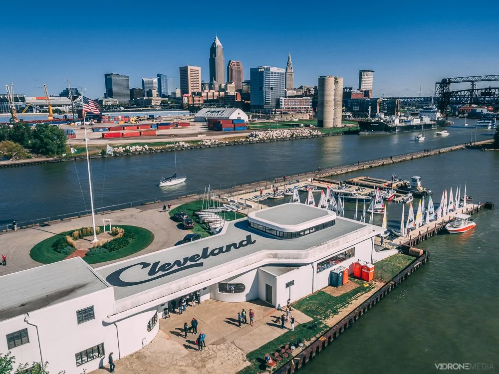
Where To Fly Drones in Cleveland
Cleveland aerial views are some of the best available in the state of Ohio! OK, we may be a little biased since we are based in the Cleveland area. We are lucky to have an extensive lakefront with Lake Erie spanning much of the Northeast Ohio border, downtown Cleveland, and its suburbs.
Drone photo of downtown Cleveland skyline and historic Cleveland Coast Guard Station
1. Downtown Cleveland has many scenic locations: Cleveland sports stadiums, Rock and Roll Hall of Fame, Public Square, Playhouse Square, etc. You can't beat the Cleveland skyline aerial view with Lake Erie in the background!
But be aware, if you intend to fly your drone downtown Cleveland, that Burke Lakefront Airport is located there just next to the Voinovich Bicentennial Park. Burke Lakefront Airport is in controlled (class D) airspace, requiring you to obtain FAA authorization to fly your drone within 5 miles of its location (you can read our blog post Where Can I Fly My Drone for detailed information and tutorial on FAA authorizations).

Aerial photo of Rock and Roll Hall of Fame with Burke Lakefront Airport and Lake Erie in the background
In addition, during any major league baseball (MLB) or national football league (NFL) open-air stadium games there is a Temporary Flight Restriction (TFR) that is in effect, which applies to the MLB and NFL games at the stadiums located downtown Cleveland. TFRs can also go into effect for other reasons, such as VIP movement, which prohibits all drone flights in the area.
2. Lakefront locations in Cleveland that offer some scenic lakefront drone photography: Lakewood Park with the Solstice Steps and Cleveland downtown skyline, Lorain Lighthouse in Lorain, and Fairport Harbor Breakwater Lighthouse in Mentor. Make sure you check municipality ordinances when you are choosing where to launch and land your drone.

Aerial view of the Edgewater Park with downtown Cleveland Skyline
3. University Circle neighborhood of Cleveland offers plenty of scenic architectural and natural sites with Wade Oval, Cleveland Museum of Art and its lagoon, Museum of Natural History, Case Western Reserve University campus, and Little Italy nearby. Some of this area is within 5 miles of the Burke Lakefront Airport, so you may need FAA authorization to fly your drone there.

Aerial photo of Cleveland Museum of Art in Fall
4. Unfortunately, you cannot launch and land your drone in most Cleveland Metroparks, including their lakefront locations: Edgewater Park, Wendy Park, Whiskey Island, E 55th Street Marina, East 72nd fishing area, North Gordon Park Boat Ramp, Euclid Beach Park, and Huntington Reservation Beach in Bay Village. There are several designated areas where you CAN fly your drone in the Cleveland Metroparks, see the details in their Drone Policy.
If you have any questions about flying in Cleveland and surrounding areas, need a drone project quote, or are looking for drone training classes that we provide, Contact us!

Why hands-on drone flight training is important for drone pilots
As a new year begins, many of us are making New Year resolutions. V1DroneMedia's resolution is to bring the most up-to-date and simple-to-understand drone knowledge to you: information about drone regulations, drone industry, equipment capabilities, flight skills, and other drone information to those interested in learning more about drone technology and getting started in flying drones safely and legally.
A lot of drone pilot schools are focused on education and compliance with the FAA drone laws and regulations and getting the Part 107 Remote Pilot License. And this IS where you should start your drone journey if you are thinking about getting a drone or just purchased one because you want to be aware of where and how to operate your drone safely and legally, avoid any negative law enforcement or 'well-wisher' attention, and can intelligently answer any questions about how and where you can legally fly. We have regularly scheduled Drone Training Courses that you can attend to learn this information and get ready for the FAA Part 107 Drone Certification Test.

V1DroneMedia’s Chief Pilot teaching Traffic Patterns during an FAA Part 107 Drone License Prep Course
However, learning safe drone operations or procuring your Part 107 Drone Pilot Certificate is only a starting point (one should walk before they run). The essential part of your drone training should be getting hands-on time flying the drone. That means being comfortable with operating the drone apps (such as DJI, Litchi, etc.), performing takeoffs and landings, learning to maintain and calibrate the drone, performing routine flight maneuvers, operate the camera to take pictures and video. These skills cannot be taught in a classroom, and you need them to fly the drone proficiently if you are serious about becoming a drone pilot. You must get out there and learn to fly your drone, just like manned aviation pilots spend hours flying in a simulator or with an instructor before flying on their own (I spent hours and days in simulator sessions during my training as a commercial pilot, and had to do recurrent training every year in a simulator as well).
While flying a drone doesn't come with the liability of flying an aircraft worth millions of dollars with people on board, it is still very important to understand the systems that make a drone work and be proficient with your equipment to ensure safe operation.
A drone is usually needed to shoot an aerial photo or video of a certain subject matter or an object on the ground or even high up in the air, and you need to have skills to fly the drone to focus on a subject, position the camera of the drone to shoot video or photo from different angles while flying around the subject, maybe even track the subject and shoot continuous video or photographs.

V1DroneMedia’s Chief Pilot with students during a hands-on drone flight session
Many of these flight maneuvers are built into intelligent flight modes in the apps nowadays, but you would still need to know how the different intelligent flight modes work and become proficient at setting them up and incorporating them into your workflow (if needed). Learning to fly in a manual mode is also very important and can be beneficial in many situations – especially if you would have to manually take control of the aircraft for any reason.
To help fill the gap in hands-on drone flight experience for aspiring drone pilots V1DroneMedia is now offering Drone Operations classes with both classroom and outdoor time for learning the drone apps, flying procedures and hands-on time, and Hands-on Flying Sessions for individuals and groups tailored to individuals' skill levels and goals. If one of your resolutions this year is to explore a drone as a hobby, learn to fly a drone proficiently, or learn advanced drone flying skills to further your drone industry career goals, Contact Us to schedule your session today! And get on an e-mail list to stay informed about our group class schedules.

Best drones to buy in 2024

A variety of drones and drone controllers
My drone story
I grew up flying RC (Remote Controlled) airplanes in the '90s, spent 20 years with a commercial airline company as a pilot, and have been a commercial drone services provider (DSP) in Cleveland, Ohio now for 8 years shooting everything from real estate, construction, building inspection to high-end TV and Film video production (you can read my story here), so I have developed some strong opinions about what drone is best to use for certain tasks.
While you will find that I am mostly recommending DJI products, that doesn't mean that other manufacturers' (Autel, Skydio, Parrot, etc.) drones are subpar (although everyone agrees DJI platform is the best in the market for commercial tasks currently),it's just that I adopted the DJI platform from the start and stuck with it because it works for me and I've learned the 'ins and outs' of their products. Investing in a new platform always takes time, so unless I am forced to quit DJI products with new regulations or there are clear advantages over existing DJI products, I am not keen on investing a lot of time and money to learn them. However, if I do find and try out new drones that provide a similar or better price/value ratio, I will update this blog post.
What is the Best Drone for Beginners and Best Small Drone?
If you are just starting with drones and are in the market for a compact drone with a camera that can produce great video and photos for you to take on the road, the DJI Mini series is your best bet as of 2024. It is highly portable with a compact folding design, easy to use with many beginner-friendly features such as autonomous flight modes like QuickShots that allow beginners to capture professional-quality footage without advanced flying skills. DJI Mini series drones (2, 3, 4 models) also have impressive image and video quality with at least 12MP for stills and up to 4K video, and come with a gimbal to ensure image and video stabilization (especially useful for beginners who may not yet have steady flying skills). All 3 DJI Mini models offer impressive flight times, ranging from 31 to 45 minutes (depending on the model and conditions), and come with standard safety features (GPS and vision sensors, and geofencing and altitude limits, preventing beginners from flying into restricted zones or too high).
What is the Best Drone for Kids and Beginners for under $200?
A few years ago I purchased the DJI Tello Drone so my wife and kids can join in on my passion for drones with this incredibly easy-to-use drone from the DJI platform. It is conveniently operated with the DJI Tello app from your smartphone touchscreen, has a camera for photos and video, and quite a few fun flying features to try out (like Bounce Mode, 8D flips, Up & Away, etc.).
My wife and kids had no problem flying and performing fun tricks with it within minutes, and if something does happen to it while they are flying it, it isn't a huge loss.
Another cost-effective and easy to use drone for beginners is Holy Stone HS175D, which has beginner-friendly controls, uses your smartphone monitor (same as Tello), has decent camera quality, GPS-assisted flight and return-to-home feature. It offers around 22 minutes of flight time (so at least 10 minutes less than DJI Tello), but comes with 2 batteries (vs. 1 with Tello). All in all it is a good choice for beginners as well.
Best Drone for Video and Cinematography
While I use the DJI Inspire 2 and DJI Mavic 3 Cine for many of my cinematography jobs, my vote for best video production drone will always go to DJI Inspire series, the most current of which on the market is Inspire 3. The Inspire series allows for using different lenses on the camera – something you can't do with the Mavic or any of the other DJI models. Couple that with the ability to shoot in Apple ProRes and CinemaDNG (aka, RAW), if you purchase DJI Inspire drone with a special license to do so, and the Inspire drone can capture video that looks far superior to the Mavic series drones.
One of the benefits of being able to shoot in ProRes or CinemaDNG is that it allows for matching the aerial shots to other cameras that are being used for filming by allowing much more flexibility in color correction and grading in drone video post-production (video editing) to get the right 'look' that they want to achieve. However, using the Inspire 2 comes with higher operational costs and therefore higher client pricing. If the client doesn't require it or doesn't want to pay for it, that is where the Mavic 2 Pro comes in.
For its small form factor, the Mavic 3 Pro can still 'pack a punch' when it comes to video. It allows for shooting in 4K, LOG (for color grading in post-production), or Normal color profiles, and has 10-bit color depth. If you know what you're doing, you can get some great imagery out of the Mavic 2 Pro.
DJI Air 3 is a great alternative to Mavic 3 Pro (and is also great for its compactness and good video quality), but I already owned a Mavic Pro series drone when Mavic Air series came out, so there is no need for me to have both.
You can check out my video portfolio here. They were all taken with one of the DJI drone series drones I am recommending here (Phantom 4 Pro, Mavic 2 and 3 Pro, Inspire 2).
Best Drone for Inspection, Mapping, Modeling, Surveying, and Construction Jobs
The workhorse of my fleet used to be DJI Phantom 4 Pro for some of these AEC industry tasks. I've owned several of its predecessors (Phantom 2 and 3 Pro) as well, so that used to be my 'go-to' drone for inspection, mapping, and 3D modeling type jobs. However since DJI came out with DJI Mavic Enterprise series, which are better suited for these purposes, I would recommend to use DJI Mavic 3 Enterprise, the most current model on the market for inspection and drone photogrammetry used for mapping and 3D modeling. It is best suited for professionals needing a portable, high-precision drone for these tasks.
An upgrade from DJI Mavic 3 Enterprise would be DJI M30. While that is a much higher investment than Mavic 3 Enterprise, its main difference is that it has more advanced features, the most valuable of which is the ability to swap camera payloads with a variety of sensors for different tasks. It is built to handle itself better in a rugged, challenging environment vs. DJI Mavic Enterprise models, making it a better choice for certain industries and tasks.
What is the Best Drone for the Money?
There is no straightforward answer here. It all depends on what job you are using the drone for.
If you are looking for a drone that can perform a variety of tasks well (including photography, photogrammetry, and video), I would recommend the DJI Mavic 3 Pro (although if you are using specifically for photogrammetry, then Mavic 3E - Enterprise series, see above).
If you are interested in finding the best photography and videography drone, the Mavic 3 PRO or Mavic Air 3 would be my choice.
If you do end up buying a drone, be sure to read my Drone Pilot License blog posts to learn more about operating your drone in a safe and legal manner.
Contact me if you are looking for a drone consultation, quote for your business, or are interested in drone flight and FAA Part 107 Certificate training. Follow me on social media to see our work and drone advice and tutorials - links are at the bottom of the website pages. Good luck and happy flying!

Where can I fly my drone?
I get this question all the time. Mostly when people see me fly my drone downtown Cleveland, Ohio, (and anywhere else). There is still a lot of confusion as to where you are legally allowed to fly.
There are 2 types of drone operators – hobbyists (recreational) and commercial operators (Part 107 license holders, like myself). As a reminder, drones are legally defined as aircraft, so their operations are subject to regulation by the FAA. This regulation applies to both recreational and commercial operations and ALL drone pilots are required to know the type of airspace they plan to fly in.
Commercial drone operators (with Part 107 certification) are required to learn and understand much more about operations within the NAS (National Airspace), and it is a major part of the FAA knowledge test for remote pilot certification. The same goes for the hobbyist drone pilots: as of 2021 they are required to take the TRUST test, preparation for which gives them basic information about the airspace types (see my TRUST test blog post for more information on that)
Types of United States National Airspace (NAS)
When planning a drone flight, you need to determine what type of airspace you are intending to fly in. If it is controlled airspace (Class B, C, D, or certain areas of E) then you will need to get FAA authorization to fly in these areas. Controlled airspace is typically found within 5 miles of an airport that has a control tower in operation.
How can I check what type of airspace I am in?
There are several ways to check what type of airspace you are intending to fly in. The easiest way is with an app that was developed in conjunction with the FAA, called B4UFLY. It provides drone pilots with a status indicator based on their current or planned location in relation to airspace restrictions. Of course, there may be additional restrictions, such as state and local regulations, that may not be shown on the app.
There are a variety of other apps available for drone pilots, including Airmap, UASidekick, and Aloft to name a few, which help determine the airspace type and the ability to request FAA flight authorizations through the app.
Uncontrolled airspace drone flight operations
As the name implies, you won’t need additional FAA authorization if you are in uncontrolled airspace. You are free to fly there, as long as you comply with basic drone operation rules (flying under 400’, not flying over people or traffic, and not interfering with traffic patterns of takeoff and landing areas, if near an airport).
How to get FAA Authorizations to fly in controlled airspace
If you’ve determined that you are going to be flying in controlled airspace (Class A, B, C, D, etc.) you must apply for an airspace authorization for altitudes below the posted UAS Facility Map grid altitudes (this applies to both recreational and commercial drone pilots)
You can get these authorizations through a variety of apps (mentioned above) that are LAANC (Low Altitude Authorization and Notification Capability) service providers, which were developed in collaboration with the FAA and the industry.
If you are unable to get authorization through the LAANC network, you will have to get authorization through the FAA DroneZone.
You can probably figure out where to go from here with the information and the links I provided, but if you want more detail and are more of a visual learner, I uploaded a video tutorial on getting drone flight authorizations through the LAANC and DroneZone on my V1DroneMedia YouTube channel.
Can I get an FAA Authorization through the DJI Fly Safe Website?
No, getting an FAA Authorization is a separate step from unlocking a DJI Fly Safe No Fly Geo Zone. I explain the difference and give the tutorial on how to unlock the DJI Fly Safe No Fly Zones in my What is DJI Fly Safe blog post.
Can I fly my drone downtown Cleveland?
If you are specifically looking to fly downtown Cleveland (since I am local, I will elaborate on this subject), you will most likely be flying in Class D (controlled) airspace. This controlled airspace exists due to Burke Lakefront airport being located in downtown Cleveland and encompasses a 5 miles radius around the airport. You will need to check the LAANC system to determine if the specific spot you are looking to fly in is within that controlled airspace and if so, you will need to get an FAA authorization to fly there. Simple, right?
Something else to be aware of when flying downtown Cleveland is the fact that there may be TFRs (Temporary Flight Restrictions) in effect – typically in effect if there is a Cleveland Indians game – TFR prohibits any drone flying during that time.
I have a few spots I tend to fly at often around Cleveland, and you can read my post Where To Fly Drones in Cleveland to learn where that is.
I hope you have a bit more clarity now about flying at your desired location. Comment here or on my YouTube video if you’ve found this helpful, and contact me if you have more questions or have a topic in mind that you’d like to learn more about. Have a safe flight!